
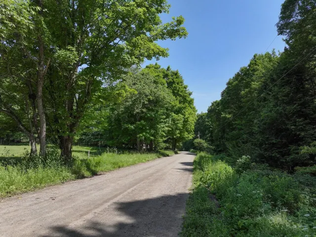
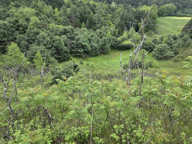
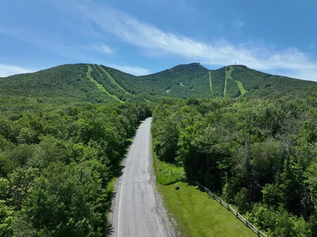

Land
$125,000
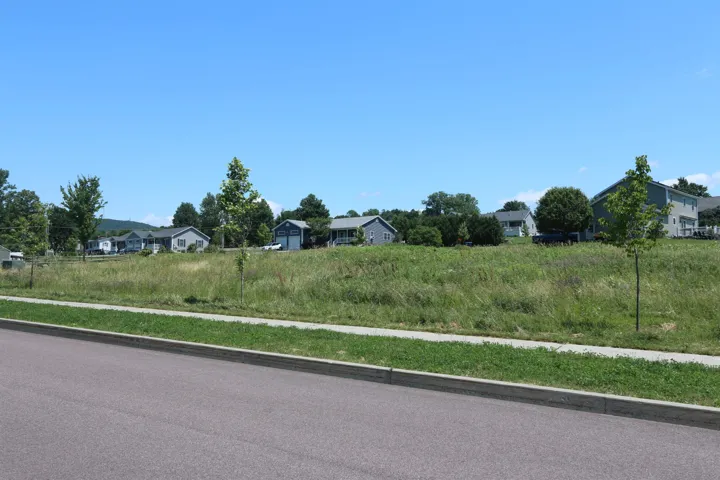
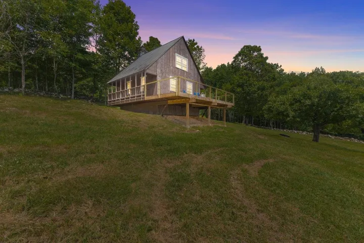
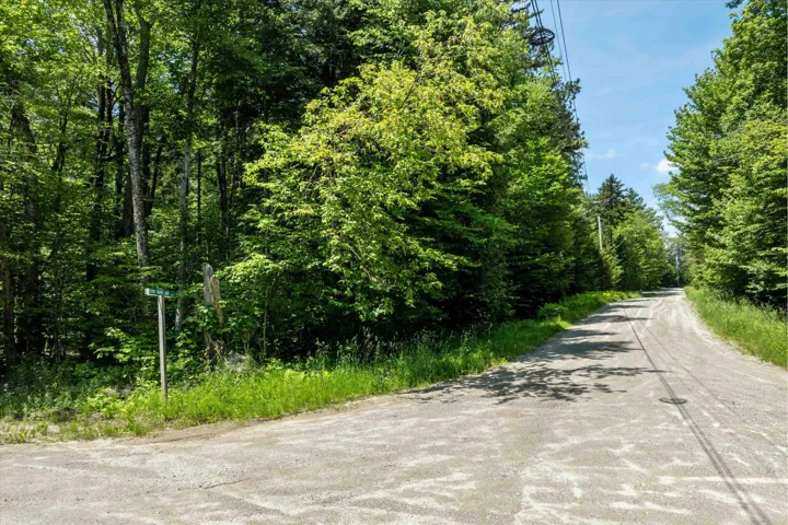
Land
$184,000
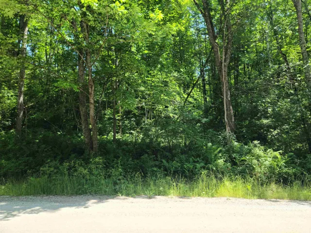
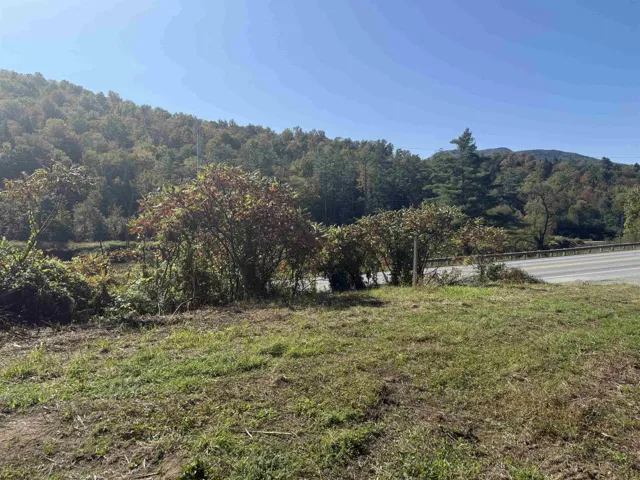
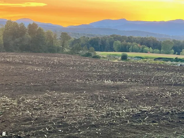
Land
$15,000
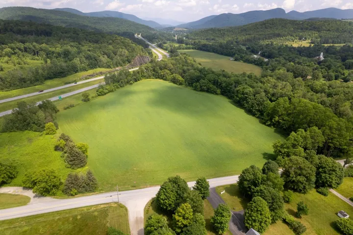
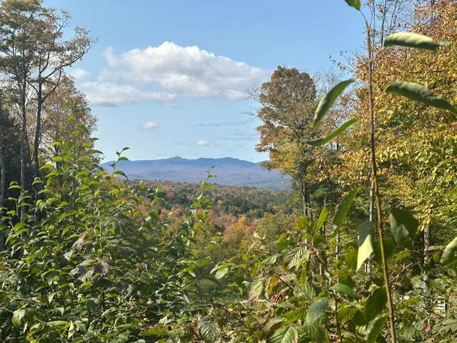
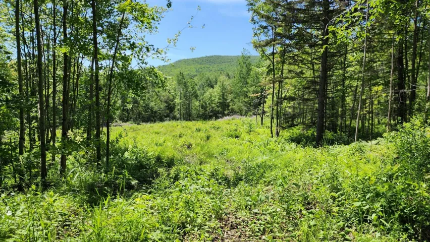
Land
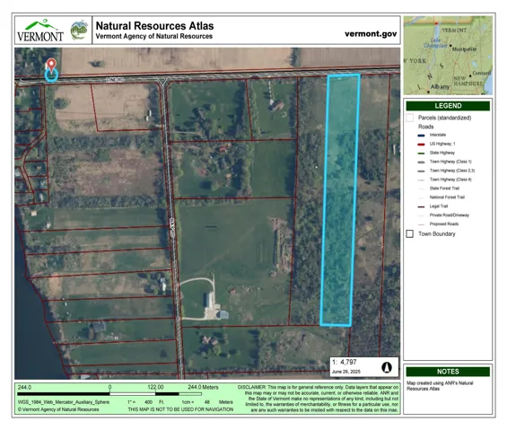
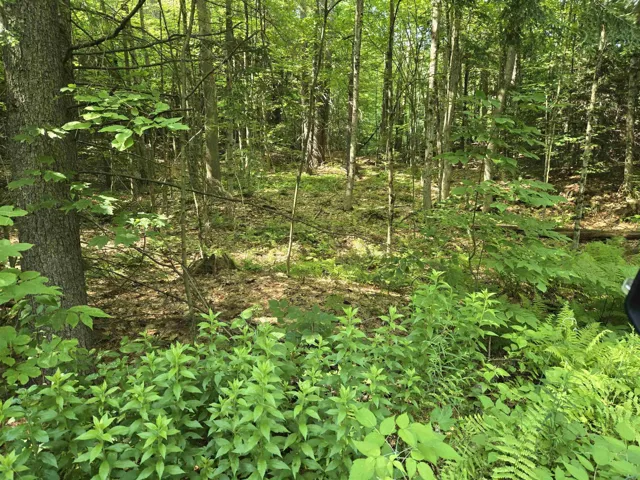
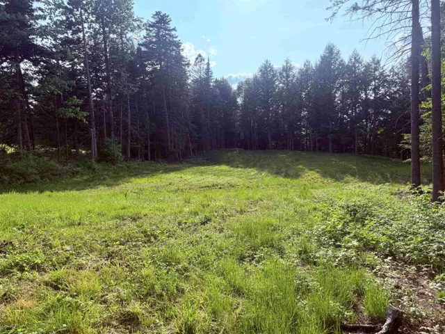
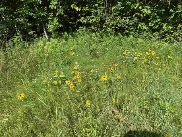
$250,000
Land
$90,000
Land
$1,050,000
Land
$250,000
Land
$175,000
Land
$290,000
Land
$565,000
Land
$300,000
Land
$800,000
Land
$390,000
Land
$65,000
Land
$300,000
Land
$190,000
Land
$102,000
Land
$72,500
Land
$225,000
Land
$115,000
Tell us a bit about what you’re looking for, and a member of our team will be in touch to help you take the next step.
Copyright 2026 PrimeMLS, Inc. All rights reserved. This information is deemed reliable, but not guaranteed. The data relating to real estate displayed on this site comes in part from the IDX Program of PrimeMLS. The information being provided is for consumers’ personal, non-commercial use and may not be used for any purpose other than to identify prospective properties consumers may be interested in purchasing. Data last updated 04/26/2026.
© 2026 Hickok & Boardman, Inc. All rights reserved. Coldwell Banker® and the Coldwell Banker Logo are registered service marks owned by Coldwell Banker Real Estate LLC. Hickok & Boardman, Inc fully supports the principles of the Fair Housing Act and the Equal Opportunity Act. Each franchise is independently owned and operated. Any services or products provided by independently owned and operated franchisees are not provided by, affliated with or related to Coldwell Banker Real Estate LLC nor any of its affiliated companies.
array:5 [ "RF Query: /Property?$select=ALL&$orderby=ModificationTimestamp desc&$top=20&$skip=780&$filter=(StateOrProvince eq 'VT' and PropertyType ne 'Commercial Lease' and PropertyType ne 'Residential Lease' and PropertyType ne 'Commercial Sale' and CountyOrParish ne 'VT-Essex' and CountyOrParish ne 'VT-Bennington' and CountyOrParish ne 'VT-Windham' and StandardStatus ne 'Deleted') and (PropertyType eq 'Land')&$expand=Media&$count=true" => array:2 [ "RF Response" => Realtyna\MlsOnTheFly\Components\CloudPost\SubComponents\RFClient\SDK\RF\RFResponse {#5280 +items: array:20 [ 0 => Realtyna\MlsOnTheFly\Components\CloudPost\SubComponents\RFClient\SDK\RF\Entities\RFProperty {#5263 +post_id: "26636" +post_author: 1 +"ListingKey": "5054658" +"ListingId": "5054658" +"PropertyType": "Land" +"StandardStatus": "Closed" +"ModificationTimestamp": "2025-12-02T22:31:15Z" +"RFModificationTimestamp": "2025-12-02T22:41:16Z" +"ListPrice": 79000.0 +"BathroomsTotalInteger": 0 +"BathroomsHalf": 0 +"BedroomsTotal": 0 +"LotSizeArea": 3.16 +"LivingArea": 0 +"BuildingAreaTotal": 0 +"City": "Cabot" +"PostalCode": "05658" +"UnparsedAddress": "00 Lovely Road, Cabot, VT 05658" +"Coordinates": array:2 [ …2] +"Latitude": "44.347615238334278" +"Longitude": "-72.269305031738298" +"YearBuilt": 0 +"InternetAddressDisplayYN": true +"FeedTypes": "IDX" +"ListOfficeName": "Edge Realty Vermont" +"ListAgentMlsId": "23260" +"ListOfficeMlsId": "6388" +"OriginatingSystemName": "PrimeMLS" +"PublicRemarks": "Welcome to lot 1, featuring 3.16+/- acres close to Mollys Falls! This is an undeveloped parcel of land nestled in a private country setting. Seller shall provide perk test results and waste water permitting for 3 bedroom home, work currently being done by Chase & Chase. This lot will require easement access via lot 2; access information recorded in deed page 95 book 854-856 in the Cabot land records. The lot is slightly sloping with approx. 1 acre cleared for a potential build site, the rest being wooded with beautiful vegetation and good mix of forest. Great location and close to Montpelier! Taxes are part of a larger parcel, tax amount listed will change. Seller will remove lot from current use. No survey, however, boundaries are clearly marked and flagged." +"BuildingAreaUnits": "Sqft" +"BuyerAgentFirstName": "Whitney" +"BuyerAgentKey": "620105" +"BuyerAgentLastName": "Brown" +"BuyerAgentMiddleName": "A" +"BuyerOfficeMlsId": "3992" +"BuyerOfficeName": "Heney Realtors - Element Real Estate (Barre)" +"CountyOrParish": "VT-Washington" +"CreationDate": "2025-08-01T21:49:14.752082+00:00" +"CurrentUse": "Unknown" +"DaysOnMarket": "76" +"Directions": "From Old Rte 2, take Lovely Rd approx .7 miles, property on R." +"Easements": "Yes" +"Electric": "At Street" +"InternetConsumerCommentYN": true +"ListAgentFirstName": "Terri" +"ListAgentKey": "381240" +"ListAgentLastName": "Edgerley" +"ListOfficeEmail": "terriedgerley@gmail.com" +"ListOfficeKey": "6388" +"ListOfficePhone": "802-279-4590" +"LivingAreaUnits": "Sqft" +"LotFeatures": "Country Setting,Slight,Sloping" +"LotSizeSquareFeet": "137650" +"LotSizeUnits": "Sqft" +"MlsStatus": "Closed" +"NumberOfLots": "1" +"OriginalEntryTimestamp": "2025-08-01" +"PhotosChangeTimestamp": "2025-12-02T22:31:15Z" +"PhotosCount": "2" +"RoadFrontageType": "TBD" +"Sewer": "None" +"StateOrProvince": "VT" +"StatusChangeTimestamp": "2025-12-02" +"StreetName": "Lovely" +"StreetNumber": "00" +"StreetSuffix": "Road" +"TaxAnnualAmount": "4325.4" +"TaxLot": "1" +"TaxYear": "2024" +"UnitNumber": "1" +"Utilities": "None" +"WaterSource": "None" +"Zoning": "Cabot" +"Resort": "No" +"AllowAVM": "Yes" +"Internet": "High Speed Intrnt Avail" +"Surveyed": "No" +"TaxesTBD": "Yes" +"Covenants": "Unknown" +"Deed-Book": "75" +"Deed-Page": "129-130" +"FloodZone": "Unknown" +"IDXInclude": "Yes" +"PropertyID": "11-039.001" +"SPANNumber": "117-036-10869" +"class_name": "LD_2" +"Date-Closed": "2025-12-02" +"Price-Closed": "77000" +"PricePerSQFT": "24367.09" +"SellingAgent": "283335" +"StatusDetail": "0" +"Date-Contract": "2025-10-16" +"SellingOffice": "6287" +"DelayedShowing": "No" +"Price-Original": "69000" +"Remarks-Public": "Welcome to lot 1, featuring 3.16+/- acres close to Mollys Falls! This is an undeveloped parcel of land nestled in a private country setting. Seller shall provide perk test results and waste water permitting for 3 bedroom home, work currently being done by Chase & Chase. This lot will require easement access via lot 2; access information recorded in deed page 95 book 854-856 in the Cabot land records. The lot is slightly sloping with approx. 1 acre cleared for a potential build site, the rest being wooded with beautiful vegetation and good mix of forest. Great location and close to Montpelier! Taxes are part of a larger parcel, tax amount listed will change. Seller will remove lot from current use. No survey, however, boundaries are clearly marked and flagged." +"Date-PriceChange": "2025-08-11" +"LO1OfficeIdentifier": "6388" +"SO1OfficeIdentifier": "6287" +"Date-ActiveUnderContr": "2025-10-16" +"LO1OfficeAbbreviation": "5519-00" +"SO1OfficeAbbreviation": "4689-03" +"DisplayListing-Internet": "Yes" +"Foreclosed/Bank-Owned/REO": "No" +"Media": array:2 [ …2] +"@odata.id": "https://api.realtyfeed.com/realtyfeed/odata/Property('5054658')" +"ID": "26636" } 1 => Realtyna\MlsOnTheFly\Components\CloudPost\SubComponents\RFClient\SDK\RF\Entities\RFProperty {#5265 +post_id: "28186" +post_author: 1 +"ListingKey": "4958531" +"ListingId": "4958531" +"PropertyType": "Land" +"StandardStatus": "Active" +"ModificationTimestamp": "2025-12-02T20:11:28Z" +"RFModificationTimestamp": "2025-12-02T20:32:29Z" +"ListPrice": 699000.0 +"BathroomsTotalInteger": 0 +"BathroomsHalf": 0 +"BedroomsTotal": 0 +"LotSizeArea": 41.0 +"LivingArea": 0 +"BuildingAreaTotal": 0 +"City": "Derby" +"PostalCode": "05829" +"UnparsedAddress": "- Pine Hill Road, Derby, VT 05829" +"Coordinates": array:2 [ …2] +"Latitude": "44.931583251228481" +"Longitude": "-72.186440783691424" +"YearBuilt": 0 +"InternetAddressDisplayYN": true +"FeedTypes": "IDX" +"ListOfficeName": "Century 21 Farm & Forest" +"ListAgentMlsId": "22563" +"ListOfficeMlsId": "3613" +"OriginatingSystemName": "PrimeMLS" +"PublicRemarks": "This 41-acre plot of land, situated in Derby (13.2A) and Newport (27.6A), is adjacent to the I-91 access road, Newport Country Club, Pine Hill Road, and Mt. Vernon St. While it is currently zoned for commercial purposes, it also presents an opportunity for residential development, which would necessitate rezoning. The undeveloped land offers potential for a large luxury residence, boasting breathtaking views of Lake Memphremagog, Jay Peak, Willoughby Gap, and downtown Newport. Plans are available for either a 7-lot commercial subdivision or a 13-lot residential subdivision with access to water and sewer facilities. Additionally, its location within the Foreign Trade Zone could lead to reduced import costs for businesses, and potential eligibility for New Market Tax Credits. This property is a must-see. Two (2) shareholders are Vermont Real Estate Brokers." +"BuildingAreaUnits": "Sqft" +"CoListAgentFirstName": "Daniel" +"CoListAgentKey": "13848" +"CoListAgentLastName": "Maclure" +"CoListAgentMiddleName": "C" +"CoListAgentMlsId": "22557" +"CoListOfficeMlsId": "3613" +"CoListOfficeName": "Century 21 Farm & Forest" +"CountyOrParish": "VT-Orleans" +"CreationDate": "2025-06-27T16:35:10.725824+00:00" +"CurrentUse": "No" +"DaysOnMarket": 1029 +"Directions": "From I-91 Access Rd take Pine Hill Rd to stop sign. Property is on right corner of Pine Hill & Mt Vernon. Lot access is first right on Mt Vernon, opposite the golf course at Newport Country Club." +"DocumentsAvailable": "Aerials,Deed,Other" +"Electric": "At Street" +"FrontageLength": "2300" +"HighSchoolDistrict": "North Country Supervisory Union" +"InternetConsumerCommentYN": true +"ListAgentFirstName": "Nicholas" +"ListAgentKey": "16388" +"ListAgentLastName": "Maclure" +"ListOfficeEmail": "nick@farmandforest.com" +"ListOfficeKey": "3613" +"ListOfficePhone": "802-334-1200" +"LivingAreaUnits": "Sqft" +"LotFeatures": "Abuts Golf Course,Near Country Club,Near Golf Course,Near Shopping,Near Skiing,Near Snowmobile Trails,Field/Pasture,Level,Major Road Frontage,Open,Sloping,View,Wetlands,Wooded" +"LotSizeSquareFeet": "1785960" +"LotSizeUnits": "Sqft" +"MlsStatus": "Active" +"OriginalEntryTimestamp": "2023-06-23" +"PhotosChangeTimestamp": "2025-06-20T07:01:18Z" +"PhotosCount": "22" +"RoadFrontageType": "Yes" +"Sewer": "On-Site Septic Needed" +"StateOrProvince": "VT" +"StatusChangeTimestamp": "2025-06-27" +"StreetName": "Pine Hill" +"StreetNumber": "-" +"StreetSuffix": "Road" +"TaxLot": "F" +"UnitNumber": "Lot F" +"Utilities": "Cable at Site" +"WaterSource": "On-Site Well Needed" +"Zoning": "Commercial" +"Map": "0" +"Resort": "No" +"Auction": "No" +"AllowAVM": "Yes" +"Internet": "Satellite Internet" +"Surveyed": "Yes" +"TaxesTBD": "Yes" +"Covenants": "Yes" +"Deed-Book": "170" +"Deed-Page": "2" +"FloodZone": "No" +"Deed2-Book": "170" +"Deed2-Page": "2" +"IDXInclude": "Yes" +"SPANNumber": "177-056-11928" +"class_name": "LD_2" +"Deeds-Total": "2" +"School-High": "North Country Union High Sch" +"SuitableUse": "Agriculture,Commercial,Development Potential,Field/Pasture,Recreation" +"CableCompany": "Comcast" +"PricePerSQFT": "17048.78" +"StatusDetail": "0" +"DelayedShowing": "No" +"Price-Original": "699000" +"Remarks-Public": "This 41-acre plot of land, situated in Derby (13.2A) and Newport (27.6A), is adjacent to the I-91 access road, Newport Country Club, Pine Hill Road, and Mt. Vernon St. While it is currently zoned for commercial purposes, it also presents an opportunity for residential development, which would necessitate rezoning. The undeveloped land offers potential for a large luxury residence, boasting breathtaking views of Lake Memphremagog, Jay Peak, Willoughby Gap, and downtown Newport. Plans are available for either a 7-lot commercial subdivision or a 13-lot residential subdivision with access to water and sewer facilities. Additionally, its location within the Foreign Trade Zone could lead to reduced import costs for businesses, and potential eligibility for New Market Tax Credits. This property is a must-see. Two (2) shareholders are Vermont Real Estate Brokers." +"ElectricCompany": "Vermont Electric" +"Date-PriceChange": "2023-06-23" +"LandRestrictions": "Deed,Mobile Homes,Other" +"School-Middle/Jr": "North Country Junior High" +"School-Elementary": "Derby Elementary" +"LO1OfficeIdentifier": "3613" +"LO2OfficeIdentifier": "3613" +"OffMarketStatusDate": "2025-06-27" +"LO1OfficeAbbreviation": "4312-0" +"LO2OfficeAbbreviation": "4312-0" +"PropertyPanoramaVTour": "https://tour.neren.com/Pine-Hill-Road-Lot-F-Derby-VT-05829/unbranded" +"DisplayListing-Internet": "Yes" +"Foreclosed/Bank-Owned/REO": "No" +"Media": array:8 [ …8] +"@odata.id": "https://api.realtyfeed.com/realtyfeed/odata/Property('4958531')" +"ID": "28186" } 2 => Realtyna\MlsOnTheFly\Components\CloudPost\SubComponents\RFClient\SDK\RF\Entities\RFProperty {#5262 +post_id: "26318" +post_author: 1 +"ListingKey": "5064540" +"ListingId": "5064540" +"PropertyType": "Land" +"StandardStatus": "Closed" +"ModificationTimestamp": "2025-12-02T16:53:51Z" +"RFModificationTimestamp": "2025-12-02T16:56:05Z" +"ListPrice": 82000.0 +"BathroomsTotalInteger": 0 +"BathroomsHalf": 0 +"BedroomsTotal": 0 +"LotSizeArea": 2.05 +"LivingArea": 0 +"BuildingAreaTotal": 0 +"City": "Williamstown" +"PostalCode": "05679" +"UnparsedAddress": "Lot 2 Blue Bird Road, Williamstown, VT 05679" +"Coordinates": array:2 [ …2] +"Latitude": "44.150775733926793" +"Longitude": "-72.531240794967673" +"YearBuilt": 0 +"InternetAddressDisplayYN": true +"FeedTypes": "IDX" +"ListOfficeName": "Heney Realtors - Element Real Estate (Montpelier)" +"ListAgentMlsId": "21353" +"ListOfficeMlsId": "6286" +"OriginatingSystemName": "PrimeMLS" +"PublicRemarks": "If your dream home starts with the perfect setting, this 2.05-acre parcel might just be your blank canvas. Perched gently between Blue Bird Road and Snow Bridge Road, this lot offers the kind of rolling Vermont views that make you want to slow down and breathe deeper. Whether you're sipping coffee on a future porch or sketching out floorplans in a sunlit field, it's easy to picture a life rooted here. You're tucked into a quiet corner with just the right balance of privacy and proximity. Barre Town is minutes away, and Exit 6 of I-89 makes the commute a breeze. The lot comes with Vermont subdivision permit EC-5-1658 and a state-approved septic design, so the groundwork is ready for you to begin building. Whether you're thinking modern farmhouse or something more timeless, this is where that vision starts. Come walk the property. Feel the breeze. Catch the light shifting across the hills. This isn’t just land. It’s the start of something beautiful." +"AttributionContact": "Cell: 802-522-5260" +"BuildingAreaUnits": "Sqft" +"BuyerAgentFirstName": "David" +"BuyerAgentKey": "627933" +"BuyerAgentLastName": "Pembroke" +"BuyerOfficeMlsId": "5956" +"BuyerOfficeName": "Dome Real Estate Group LLC" +"CountyOrParish": "VT-Orange" +"CreationDate": "2025-10-06T18:09:34.300968+00:00" +"CurrentUse": "Unknown" +"DaysOnMarket": "21" +"Directions": "From I89, on VT Route 63, at 4-way intersection go right on Miller (toward Williamstown) take the first quick left on West Road. West Road becomes Falls Bridge Road. Go 1.36 miles+/- from Rt 63 to Snow Bridge Road on left. Follow Snowbridge Road to Bluebird Road on right." +"DocumentsAvailable": "Other,Plat/Grid Map,Property Disclosure,Septic Design" +"Electric": "On-Site" +"FrontageLength": "603" +"HighSchoolDistrict": "Central Vermont Supervisory Unio" +"InternetConsumerCommentYN": true +"ListAgentFirstName": "Timothy" +"ListAgentKey": "13719" +"ListAgentLastName": "Heney" +"ListOfficeEmail": "heney@heneyrealtors.com" +"ListOfficeKey": "3992" +"ListOfficePhone": "802-229-0345" +"LivingAreaUnits": "Sqft" +"LotFeatures": "Corner" +"LotSizeSquareFeet": "89298" +"LotSizeUnits": "Sqft" +"MlsStatus": "Closed" +"NumberOfLots": "1" +"OriginalEntryTimestamp": "2025-10-06" +"PhotosChangeTimestamp": "2025-12-02T16:53:51Z" +"PhotosCount": "25" +"Possession": "At Closing" +"RoadFrontageType": "Yes" +"Sewer": "On-Site Septic Needed,Septic Design Available" +"StateOrProvince": "VT" +"StatusChangeTimestamp": "2025-12-02" +"StreetName": "Blue Bird" +"StreetNumber": "Lot 2" +"StreetSuffix": "Road" +"Utilities": "None" +"WaterSource": "On-Site Well Needed" +"Zoning": "none" +"Resort": "No" +"AllowAVM": "Yes" +"Internet": "None" +"Surveyed": "Unknown" +"TaxesTBD": "Yes" +"Covenants": "Yes" +"Deed-Book": "191" +"Deed-Page": "79-80" +"FloodZone": "Unknown" +"IDXInclude": "Yes" +"SPANNumber": "756-240-11558 (part of)" +"class_name": "LD_2" +"Date-Closed": "2025-12-01" +"School-High": "Williamstown High School" +"Date-Pending": "2025-10-27" +"Price-Closed": "82000" +"PricePerSQFT": "40000" +"SellingAgent": "291060" +"StatusDetail": "0" +"Date-Contract": "2025-10-27" +"SellingOffice": "5956" +"DelayedShowing": "No" +"Price-Original": "82000" +"Remarks-Public": "If your dream home starts with the perfect setting, this 2.05-acre parcel might just be your blank canvas. Perched gently between Blue Bird Road and Snow Bridge Road, this lot offers the kind of rolling Vermont views that make you want to slow down and breathe deeper. Whether you're sipping coffee on a future porch or sketching out floorplans in a sunlit field, it's easy to picture a life rooted here. You're tucked into a quiet corner with just the right balance of privacy and proximity. Barre Town is minutes away, and Exit 6 of I-89 makes the commute a breeze. The lot comes with Vermont subdivision permit EC-5-1658 and a state-approved septic design, so the groundwork is ready for you to begin building. Whether you're thinking modern farmhouse or something more timeless, this is where that vision starts. Come walk the property. Feel the breeze. Catch the light shifting across the hills. This isn’t just land. It’s the start of something beautiful." +"ElectricCompany": "Washington Electric Coop" +"Date-PriceChange": "2025-10-06" +"School-Middle/Jr": "Williamstown Middle/High Sch" +"School-Elementary": "Williamstown Elementary School" +"LO1OfficeIdentifier": "6286" +"SO1OfficeIdentifier": "5956" +"LO1OfficeAbbreviation": "4689-02" +"SO1OfficeAbbreviation": "5267-00" +"DisplayListing-Internet": "Yes" +"Foreclosed/Bank-Owned/REO": "No" +"Media": array:25 [ …25] +"@odata.id": "https://api.realtyfeed.com/realtyfeed/odata/Property('5064540')" +"ID": "26318" } 3 => Realtyna\MlsOnTheFly\Components\CloudPost\SubComponents\RFClient\SDK\RF\Entities\RFProperty {#5266 +post_id: "25890" +post_author: 1 +"ListingKey": "5050912" +"ListingId": "5050912" +"PropertyType": "Land" +"StandardStatus": "Active" +"ModificationTimestamp": "2025-12-02T16:48:46Z" +"RFModificationTimestamp": "2025-12-02T16:56:06Z" +"ListPrice": 249000.0 +"BathroomsTotalInteger": 0 +"BathroomsHalf": 0 +"BedroomsTotal": 0 +"LotSizeArea": 39.12 +"LivingArea": 0 +"BuildingAreaTotal": 0 +"City": "Barton" +"PostalCode": "05822" +"UnparsedAddress": "Tbd Stevens Road, Barton, VT 05822" +"Coordinates": array:2 [ …2] +"Latitude": "44.743497319297667" +"Longitude": "-72.238314392089848" +"YearBuilt": 0 +"InternetAddressDisplayYN": true +"FeedTypes": "IDX" +"ListOfficeName": "Big Bear Real Estate" +"ListAgentMlsId": "292741" +"ListOfficeMlsId": "3603" +"OriginatingSystemName": "PrimeMLS" +"PublicRemarks": "Here is an opportunity to own a pristine piece of land consisting of pasture, woods, and waterfront. On this private setting, there are multiple possible sites available to build your dream home. The iconic Parker Pie restaurant is only a couple minutes down the road where they have some of the best pizza around. The land surrounds Bakers Pond where you can enjoy all sorts of water activities or just relax and enjoy the nature. People say the bird watching here is the best around. The previous owner has built a road in with 15k worth of large stone, and the new owners can finish it off. There are two points where electricity can be brought in. One of the spots is where the road enters and the other is closer to the pond. Also, the pasture portion has a south facing lot that might be a great spot for solar. The previous owner also cleared a spot where a house with a walkout basement would fit perfectly. A dock and shipping container will convey with sale. The land has endless possibilities offering privacy and only minutes to Barton Village. This area offers multiple lakes, not to mention, multiple ski mountains and golf courses. There is VAST access directly across the road for snowmobiling, and VASA runs right down the road if you you want to ATV. It would make a great retreat or a permanent homestead. Come checkout this piece of serenity and make it yours." +"BuildingAreaUnits": "Sqft" +"CountyOrParish": "VT-Orleans" +"CreationDate": "2025-07-10T14:44:54.892669+00:00" +"CurrentUse": "No" +"DaysOnMarket": 289 +"Directions": "From I-91 Barton exit take RT 16 to Roaring Brook Rd, then travel approximately 2.7 miles. Turn right onto County Rd and then turn right again onto Stevens Rd. Head down Stevens Rd approximately 1 mile, then turn right onto property where sign is located." +"Electric": "None" +"FrontageLength": "50" +"HighSchoolDistrict": "Orleans Central" +"InternetConsumerCommentYN": true +"ListAgentFirstName": "Brandon" +"ListAgentKey": "629650" +"ListAgentLastName": "Malshuk" +"ListOfficeEmail": "info@bigbearrevt.com" +"ListOfficeKey": "3603" +"ListOfficePhone": "802-744-6844" +"LivingAreaUnits": "Sqft" +"LotFeatures": "Near Golf Course,Near Skiing,Near Snowmobile Trails,Rural,Country Setting,Field/Pasture,Mountain View,Pond,Pond Frontage,Secluded,Sloping,View,Water View,Waterfront,Wooded,Near ATV Trail" +"LotSizeSquareFeet": "1704067" +"LotSizeUnits": "Sqft" +"MlsStatus": "Active" +"OriginalEntryTimestamp": "2025-07-10" +"PhotosChangeTimestamp": "2025-07-10T14:26:38Z" +"PhotosCount": "52" +"RoadFrontageType": "Yes" +"Sewer": "None" +"StateOrProvince": "VT" +"StatusChangeTimestamp": "2025-07-10" +"StreetName": "STEVENS" +"StreetNumber": "TBD" +"StreetSuffix": "Road" +"TaxAnnualAmount": "2046.55" +"TaxYear": "2024" +"Utilities": "None" +"WaterBodyName": "Baker Pond" +"WaterSource": "None" +"WaterfrontYN": true +"Zoning": "Town" +"Resort": "No" +"Auction": "No" +"AllowAVM": "Yes" +"Internet": "Unknown" +"Surveyed": "Yes" +"TaxesTBD": "Yes" +"Covenants": "No" +"Deed-Book": "188" +"Deed-Page": "737-738" +"FloodZone": "No" +"ROW-Width": "50" +"WaterView": "Yes" +"IDXInclude": "Yes" +"ROW-Length": "473" +"SPANNumber": "042-013-11058" +"class_name": "LD_2" +"School-High": "Lake Region Union High Sch" +"PricePerSQFT": "6365.03" +"StatusDetail": "0" +"WaterBodyType": "Pond" +"DelayedShowing": "No" +"Price-Original": "290000" +"Remarks-Public": "Here is an opportunity to own a pristine piece of land consisting of pasture, woods, and waterfront. On this private setting, there are multiple possible sites available to build your dream home. The iconic Parker Pie restaurant is only a couple minutes down the road where they have some of the best pizza around. The land surrounds Bakers Pond where you can enjoy all sorts of water activities or just relax and enjoy the nature. People say the bird watching here is the best around. The previous owner has built a road in with 15k worth of large stone, and the new owners can finish it off. There are two points where electricity can be brought in. One of the spots is where the road enters and the other is closer to the pond. Also, the pasture portion has a south facing lot that might be a great spot for solar. The previous owner also cleared a spot where a house with a walkout basement would fit perfectly. A dock and shipping container will convey with sale. The land has endless possibilities offering privacy and only minutes to Barton Village. This area offers multiple lakes, not to mention, multiple ski mountains and golf courses. There is VAST access directly across the road for snowmobiling, and VASA runs right down the road if you you want to ATV. It would make a great retreat or a permanent homestead. Come checkout this piece of serenity and make it yours." +"WaterBodyAccess": "Yes" +"Date-PriceChange": "2025-12-02" +"ROW-ParcelAccess": "Yes" +"School-Middle/Jr": "Barton Academy & Graded School" +"School-Elementary": "Barton Academy & Graded School" +"WaterAccessDetails": "Dock Access" +"LO1OfficeIdentifier": "3603" +"LO1OfficeAbbreviation": "4303-0" +"PropertyPanoramaVTour": "https://tour.neren.com/TBD-STEVENS-Road-Barton-VT-05822/unbranded" +"WaterBodyRestrictions": "Yes" +"DisplayListing-Internet": "Yes" +"WaterfrontPropertyRights": "Exclusively Owned" +"Foreclosed/Bank-Owned/REO": "No" +"Media": array:52 [ …52] +"@odata.id": "https://api.realtyfeed.com/realtyfeed/odata/Property('5050912')" +"ID": "25890" } 4 => Realtyna\MlsOnTheFly\Components\CloudPost\SubComponents\RFClient\SDK\RF\Entities\RFProperty {#5264 +post_id: "26503" +post_author: 1 +"ListingKey": "5047696" +"ListingId": "5047696" +"PropertyType": "Land" +"StandardStatus": "Active" +"ModificationTimestamp": "2025-12-02T16:37:57Z" +"RFModificationTimestamp": "2025-12-02T16:56:07Z" +"ListPrice": 272000.0 +"BathroomsTotalInteger": 0 +"BathroomsHalf": 0 +"BedroomsTotal": 0 +"LotSizeArea": 34.0 +"LivingArea": 0 +"BuildingAreaTotal": 0 +"City": "Bridport" +"PostalCode": "05734" +"UnparsedAddress": "4376 Vt-22a, Bridport, VT 05734" +"Coordinates": array:2 [ …2] +"Latitude": "43.968538308011411" +"Longitude": "-73.311412306884776" +"YearBuilt": 0 +"InternetAddressDisplayYN": true +"FeedTypes": "IDX" +"ListOfficeName": "Preferred Properties" +"ListAgentMlsId": "26047" +"ListOfficeMlsId": "4553" +"OriginatingSystemName": "PrimeMLS" +"PublicRemarks": "A wonderful mixture of agricultural fields and majestic woods on this 34+/- acre lot located in the small farming community of Bridport, VT. Stunning views across Lake Champlain to the towering Adirondack Mountains in NY, Addison County Vermont is a highly sought-after area. Easy commute to Middlebury VT. 22A is a paved state maintained two lane road, no mud, dirt and dust here! Tri-town municipal water on-site and fiber internet at road, power is on a pedestal on the lot. Imagine your home set back just inside the woods with a simple view corridor cut the northwest to take advantage of the view, while providing wonderful privacy. 10+/- acres of Ag fields have been hayed regularly and offer the new owner the opportunity for a small vegetable/animal farm with room for a farmstand. The stream on the property is seasonal. The Bridport Central School is just a ½ mile north with a great playground. The town has a great Hardware/Everything store and a nice fresh market with a gas station. Your commute will be through the scenic Champlain Valley, corn and hayfields, dairy barns, and the Adirondacks to the west and Green Mountains to the east. The property leases 1.5 acres to a solar array and this pays $2300 a year, covering over half of your property taxes. The array powers the local Woodchuck Cider brewery. Further tax reduction is available through placing the land in the timber/Ag tax program know locally as Vermont Current Use. A fantastic place to call home." +"AttributionContact": "Off: 802-862-9106" +"BuildingAreaUnits": "Sqft" +"CoListAgentFirstName": "Michael" +"CoListAgentKey": "609696" +"CoListAgentLastName": "Wrobel" +"CoListAgentMlsId": "26054" +"CoListOfficeMlsId": "4553" +"CoListOfficeName": "Preferred Properties" +"CountyOrParish": "VT-Addison" +"CreationDate": "2025-06-20T14:28:28.461464+00:00" +"CurrentUse": "No" +"DaysOnMarket": 310 +"Directions": "4376 VT Route 22A, Bridport, VT: Travelling south from Bridport center look for Short Road on your right. Property is approximately ¼ mile south on your right. Look for RE sign and solar panels. The driveway to park is in front of solar panels on the southern border of the lot." +"Easements": "Yes" +"Electric": "At Street,On-Site" +"FrontageLength": "507" +"HighSchoolDistrict": "Addison Central" +"InternetConsumerCommentYN": true +"ListAgentFirstName": "Curtis" +"ListAgentKey": "393603" +"ListAgentLastName": "Trousdale" +"ListOfficeEmail": "info@preferredpropertiesvt.com" +"ListOfficeKey": "4553" +"ListOfficePhone": "802-862-9106" +"LivingAreaUnits": "Sqft" +"LotFeatures": "Near Country Club,Rural,Agricultural,Country Setting,Field/Pasture,Level,Major Road Frontage,Mountain View,Open,Recreational,View,Wooded" +"LotSizeSquareFeet": "1481040" +"LotSizeUnits": "Sqft" +"MlsStatus": "Active" +"NumberOfLots": "1" +"OriginalEntryTimestamp": "2025-06-19" +"PhotosChangeTimestamp": "2025-06-20T14:19:08Z" +"PhotosCount": "50" +"Possession": "At Closing" +"RoadFrontageType": "Yes" +"Sewer": "None,On-Site Septic Needed" +"StateOrProvince": "VT" +"StatusChangeTimestamp": "2025-06-20" +"StreetName": "VT-22A" +"StreetNumber": "4376" +"TaxAnnualAmount": "4259.76" +"TaxYear": "2025" +"Utilities": "Telephone Available" +"WaterSource": "Public Water at Street" +"WaterfrontYN": false +"Zoning": "R-2 & RA-5" +"Resort": "No" +"Auction": "No" +"AllowAVM": "Yes" +"Internet": "Fiber Optic Internt Avail,High Speed Intrnt Avail,Fiber Optic Internet" +"Surveyed": "Unknown" +"TaxesTBD": "No" +"Covenants": "No" +"Deed-Book": "65" +"Deed-Page": "39" +"FloodZone": "No" +"WaterView": "No" +"IDXInclude": "Yes" +"PoleNumber": "3/276-01" +"PropertyID": "11-073" +"SPANNumber": "087-027-10709" +"class_name": "LD_2" +"FuelCompany": "Choice" +"School-High": "Middlebury Senior UHSD #3" +"CableCompany": "Waitsfield Telecom" +"PhoneCompany": "Waitsfield Telecom" +"PricePerSQFT": "8000" +"StatusDetail": "0" +"AssessmentYear": "2023" +"DelayedShowing": "No" +"Price-Original": "272000" +"Remarks-Public": "A wonderful mixture of agricultural fields and majestic woods on this 34+/- acre lot located in the small farming community of Bridport, VT. Stunning views across Lake Champlain to the towering Adirondack Mountains in NY, Addison County Vermont is a highly sought-after area. Easy commute to Middlebury VT. 22A is a paved state maintained two lane road, no mud, dirt and dust here! Tri-town municipal water on-site and fiber internet at road, power is on a pedestal on the lot. Imagine your home set back just inside the woods with a simple view corridor cut the northwest to take advantage of the view, while providing wonderful privacy. 10+/- acres of Ag fields have been hayed regularly and offer the new owner the opportunity for a small vegetable/animal farm with room for a farmstand. The stream on the property is seasonal. The Bridport Central School is just a ½ mile north with a great playground. The town has a great Hardware/Everything store and a nice fresh market with a gas station. Your commute will be through the scenic Champlain Valley, corn and hayfields, dairy barns, and the Adirondacks to the west and Green Mountains to the east. The property leases 1.5 acres to a solar array and this pays $2300 a year, covering over half of your property taxes. The array powers the local Woodchuck Cider brewery. Further tax reduction is available through placing the land in the timber/Ag tax program know locally as Vermont Current Use. A fantastic place to call home." +"ElectricCompany": "Green Mountain Power" +"WaterBodyAccess": "No" +"AssessmentAmount": "275000" +"Date-PriceChange": "2025-06-20" +"ROW-ParcelAccess": "No" +"ROWtootherParcel": "No" +"School-Middle/Jr": "Middlebury Union Middle #3" +"School-Elementary": "Bridport Central School" +"LO1OfficeIdentifier": "4553" +"LO2OfficeIdentifier": "4553" +"LO1OfficeAbbreviation": "6430-0" +"LO2OfficeAbbreviation": "6430-0" +"PropertyPanoramaVTour": "https://tour.neren.com/4376-Vt22A-Bridport-VT-05734/unbranded" +"DisplayListing-Internet": "Yes" +"Foreclosed/Bank-Owned/REO": "No" +"Media": array:50 [ …50] +"@odata.id": "https://api.realtyfeed.com/realtyfeed/odata/Property('5047696')" +"ID": "26503" } 5 => Realtyna\MlsOnTheFly\Components\CloudPost\SubComponents\RFClient\SDK\RF\Entities\RFProperty {#5261 +post_id: "28472" +post_author: 1 +"ListingKey": "5049238" +"ListingId": "5049238" +"PropertyType": "Land" +"StandardStatus": "Active" +"ModificationTimestamp": "2025-12-02T14:14:42Z" +"RFModificationTimestamp": "2025-12-02T14:20:39Z" +"ListPrice": 1050000.0 +"BathroomsTotalInteger": 0 +"BathroomsHalf": 0 +"BedroomsTotal": 0 +"LotSizeArea": 26.2 +"LivingArea": 0 +"BuildingAreaTotal": 0 +"City": "Jericho" +"PostalCode": "05465" +"UnparsedAddress": "91 Governor Peck Road, Jericho, VT 05465" +"Coordinates": array:2 [ …2] +"Latitude": "44.439264709708901" +"Longitude": "-72.992660746032612" +"YearBuilt": 0 +"InternetAddressDisplayYN": true +"FeedTypes": "IDX" +"ListOfficeName": "KW Vermont" +"ListAgentMlsId": "288426" +"ListOfficeMlsId": "857" +"OriginatingSystemName": "PrimeMLS" +"PublicRemarks": "Introducing Acorn Ridge—Jericho’s newest luxury neighborhood, and a rare development opportunity in one of Chittenden County’s most sought-after towns. Phase I features 8 premium multi-acre homesites spanning over 26 acres. Each lot is fully permitted for a 5-bedroom single-family home with a private well and septic, and includes a generously sized building envelope for flexible, thoughtful site design. Set well off the main road, just minutes from Jericho Village and only three minutes to I-89 in Richmond, this location offers the ideal mix of privacy and accessibility. Enjoy a peaceful country setting with easy access to amenities, outdoor recreation, and everyday essentials. With substantial lot sizes, a scenic backdrop, and an unbeatable location—this is your chance to create one of Jericho’s most desirable new neighborhoods!" +"AttributionContact": "Phone: 802-488-3487" +"BuildingAreaUnits": "Sqft" +"CountyOrParish": "VT-Chittenden" +"CreationDate": "2025-06-30T15:31:59.721008+00:00" +"CurrentUse": "No" +"DaysOnMarket": 299 +"Directions": "GPS can sometimes take you to the wrong location. From Exit 11, take US-2 W or W Main Street, turn right at the light onto Vermont Rte 117 W. Take another right onto Governor Peck Road. In about 1.7 miles, the property will be on your right hand side." +"DocumentsAvailable": "Deed,Plot Plan,Survey,Tax Map" +"Electric": "At Street" +"HighSchoolDistrict": "Mount Mansfield USD 17" +"InternetConsumerCommentYN": true +"ListAgentFirstName": "Templeton" +"ListAgentKey": "625298" +"ListAgentLastName": "Real Estate Group" +"ListOfficeEmail": "frontdesk@vermontkw.com" +"ListOfficeKey": "857" +"ListOfficePhone": "802-654-8500" +"LivingAreaUnits": "Sqft" +"LotFeatures": "Rural,Country Setting,Level,Sloping,Wooded" +"LotSizeSquareFeet": "1141272" +"LotSizeUnits": "Sqft" +"MlsStatus": "Active" +"NumberOfLots": "8" +"OriginalEntryTimestamp": "2025-06-30" +"PhotosChangeTimestamp": "2025-11-04T14:16:09Z" +"PhotosCount": "15" +"Possession": "At Closing" +"RoadFrontageType": "No" +"Sewer": "On-Site Septic Needed,Private" +"StateOrProvince": "VT" +"StatusChangeTimestamp": "2025-06-30" +"StreetName": "Governor Peck" +"StreetNumber": "91" +"StreetSuffix": "Road" +"SubdivisionName": "Acorn Ridge" +"TaxAnnualAmount": "4170.26" +"TaxYear": "2025" +"Utilities": "None" +"WaterSource": "On-Site Well Needed,Private" +"WaterfrontYN": false +"Zoning": "Rural Ag Residential" +"Resort": "No" +"Auction": "No" +"AllowAVM": "Yes" +"Internet": "None" +"Surveyed": "Yes" +"TaxesTBD": "Yes" +"Covenants": "Yes" +"Deed-Book": "364" +"Deed-Page": "695-697" +"FloodZone": "Land Only" +"WaterView": "No" +"IDXInclude": "Yes" +"PropertyID": "GV091." +"SPANNumber": "333-103-11812" +"SurveyedBy": "Daniel Mulligan" +"class_name": "LD_2" +"School-High": "Mt. Mansfield USD #17" +"PricePerSQFT": "40076.34" +"StatusDetail": "0" +"DelayedShowing": "No" +"Price-Original": "1100000" +"Remarks-Public": "Introducing Acorn Ridge—Jericho’s newest luxury neighborhood, and a rare development opportunity in one of Chittenden County’s most sought-after towns. Phase I features 8 premium multi-acre homesites spanning over 26 acres. Each lot is fully permitted for a 5-bedroom single-family home with a private well and septic, and includes a generously sized building envelope for flexible, thoughtful site design. Set well off the main road, just minutes from Jericho Village and only three minutes to I-89 in Richmond, this location offers the ideal mix of privacy and accessibility. Enjoy a peaceful country setting with easy access to amenities, outdoor recreation, and everyday essentials. With substantial lot sizes, a scenic backdrop, and an unbeatable location—this is your chance to create one of Jericho’s most desirable new neighborhoods!" +"WaterBodyAccess": "No" +"Date-PriceChange": "2025-10-06" +"School-Middle/Jr": "Browns River Middle USD #17" +"School-Elementary": "Jericho Elementary School" +"LO1OfficeIdentifier": "857" +"LO1OfficeAbbreviation": "1844-0" +"DisplayListing-Internet": "Yes" +"Foreclosed/Bank-Owned/REO": "No" +"Media": array:15 [ …15] +"@odata.id": "https://api.realtyfeed.com/realtyfeed/odata/Property('5049238')" +"ID": "28472" } 6 => Realtyna\MlsOnTheFly\Components\CloudPost\SubComponents\RFClient\SDK\RF\Entities\RFProperty {#5187 +post_id: "29092" +post_author: 1 +"ListingKey": "5070937" +"ListingId": "5070937" +"PropertyType": "Land" +"StandardStatus": "Active" +"ModificationTimestamp": "2025-12-02T01:23:29Z" +"RFModificationTimestamp": "2025-12-02T04:38:27Z" +"ListPrice": 52500.0 +"BathroomsTotalInteger": 0 +"BathroomsHalf": 0 +"BedroomsTotal": 0 +"LotSizeArea": 0.18 +"LivingArea": 0 +"BuildingAreaTotal": 0 +"City": "Barre City" +"PostalCode": "05641" +"UnparsedAddress": "Lot # 11 Maplewood Avenue, Barre City, VT 05641" +"Coordinates": array:2 [ …2] +"Latitude": "44.205786089760956" +"Longitude": "-72.497295253967238" +"YearBuilt": 0 +"InternetAddressDisplayYN": true +"FeedTypes": "IDX" +"ListOfficeName": "RE/Max Heritage" +"ListAgentMlsId": "22247" +"ListOfficeMlsId": "5957" +"OriginatingSystemName": "PrimeMLS" +"PublicRemarks": "This lot is one of two owned by the same owner, and a rare find in Barre City. Situated on a quiet dead-end road with the "Cow Pasture" next door offering walking trails just steps from your property. The property is one of two adjoining lots that may be purchased together or individually. Just a short distance to schools, shopping, and everything else Barre has to offer!" +"BuildingAreaUnits": "Sqft" +"CountyOrParish": "VT-Washington" +"CreationDate": "2025-12-01T18:26:56.519933+00:00" +"CurrentUse": "No" +"DaysOnMarket": 145 +"Directions": "From North Main Street in Barre town, turn onto Merchant Street. Turn right on Wellington Street. Turn left on Sheridan Street. Turn right on Burns Street, then left on Maplewood Ave. The property will be on the right just before the parking for the Cow Pasture." +"Electric": "At Street" +"FrontageLength": "77" +"HighSchoolDistrict": "Barre City School District" +"InternetConsumerCommentYN": true +"ListAgentFirstName": "Mathew" +"ListAgentKey": "612993" +"ListAgentLastName": "Ghafoori" +"ListOfficeEmail": "Mathewgvt@gmail.com" +"ListOfficeKey": "5957" +"ListOfficePhone": "802-748-7808" +"LivingAreaUnits": "Sqft" +"LotFeatures": "In Town,Near Paths,Near Shopping,Alternative Lots Avail,City Lot,Subdivision,Trail/Near Trail,View,Walking Trails,Wooded,Near School(s)" +"LotSizeSquareFeet": "7841" +"LotSizeUnits": "Sqft" +"MlsStatus": "Active" +"NumberOfLots": "1" +"OriginalEntryTimestamp": "2025-12-01" +"PhotosChangeTimestamp": "2025-12-01T18:11:49Z" +"PhotosCount": "14" +"RoadFrontageType": "Yes" +"Sewer": "Public,Public Sewer at Street" +"StateOrProvince": "VT" +"StatusChangeTimestamp": "2025-12-01" +"StreetName": "Maplewood" +"StreetNumber": "Lot # 11" +"StreetSuffix": "Avenue" +"TaxAnnualAmount": "183.48" +"TaxYear": "2025" +"UnitNumber": "Lot #11" +"Utilities": "Cable Available" +"WaterSource": "Public,Public Water at Street" +"Zoning": "Barre Town" +"Resort": "No" +"AllowAVM": "Yes" +"Internet": "High Speed Intrnt Avail" +"Surveyed": "Unknown" +"TaxesTBD": "No" +"Covenants": "No" +"Deed-Book": "423" +"Deed-Page": "91-92" +"FloodZone": "No" +"IDXInclude": "Yes" +"SPANNumber": "036-011-13465" +"class_name": "LD_2" +"School-High": "Spaulding High School" +"PricePerSQFT": "291666.67" +"StatusDetail": "0" +"DelayedShowing": "No" +"Price-Original": "52500" +"Remarks-Public": "This lot is one of two owned by the same owner, and a rare find in Barre City. Situated on a quiet dead-end road with the "Cow Pasture" next door offering walking trails just steps from your property. The property is one of two adjoining lots that may be purchased together or individually. Just a short distance to schools, shopping, and everything else Barre has to offer!" +"Date-PriceChange": "2025-12-01" +"School-Middle/Jr": "Barre City Elem & Middle Sch" +"School-Elementary": "Barre City Elem & Middle Sch" +"LO1OfficeIdentifier": "5957" +"LO1OfficeAbbreviation": "5268-00" +"PropertyPanoramaVTour": "https://tour.neren.com/Lot-11-Maplewood-Avenue-Lot-11-Barre-City-VT-05641/unbranded" +"DisplayListing-Internet": "Yes" +"Foreclosed/Bank-Owned/REO": "No" +"Media": array:14 [ …14] +"@odata.id": "https://api.realtyfeed.com/realtyfeed/odata/Property('5070937')" +"ID": "29092" } 7 => Realtyna\MlsOnTheFly\Components\CloudPost\SubComponents\RFClient\SDK\RF\Entities\RFProperty {#5267 +post_id: "29093" +post_author: 1 +"ListingKey": "5070934" +"ListingId": "5070934" +"PropertyType": "Land" +"StandardStatus": "Active" +"ModificationTimestamp": "2025-12-02T01:22:53Z" +"RFModificationTimestamp": "2025-12-02T04:38:27Z" +"ListPrice": 42500.0 +"BathroomsTotalInteger": 0 +"BathroomsHalf": 0 +"BedroomsTotal": 0 +"LotSizeArea": 0.18 +"LivingArea": 0 +"BuildingAreaTotal": 0 +"City": "Barre City" +"PostalCode": "05641" +"UnparsedAddress": "Lot # 10 Maplewood Avenue, Barre City, VT 05641" +"Coordinates": array:2 [ …2] +"Latitude": "44.205602293317789" +"Longitude": "-72.497913869697513" +"YearBuilt": 0 +"InternetAddressDisplayYN": true +"FeedTypes": "IDX" +"ListOfficeName": "RE/Max Heritage" +"ListAgentMlsId": "22247" +"ListOfficeMlsId": "5957" +"OriginatingSystemName": "PrimeMLS" +"PublicRemarks": "This lot is one of two owned by the same owner, and a rare find in Barre City. Situated on a quiet dead-end road with the "Cow Pasture" next door offering walking trails just steps from your property. The property is one of two adjoining lots that may be purchased together or individually. Just a short distance to schools, shopping, and everything else Barre has to offer!" +"BuildingAreaUnits": "Sqft" +"CountyOrParish": "VT-Washington" +"CreationDate": "2025-12-01T18:05:26.023762+00:00" +"CurrentUse": "No" +"DaysOnMarket": 145 +"Directions": "From North Main Street in Barre town, turn onto Merchant Street. Turn right on Wellington Street. Turn left on Sheridan Street. Turn right on Burns Street, then left on Maplewood Ave. The property will be on the right just before the parking for the Cow Pasture." +"Electric": "At Street" +"FrontageLength": "75" +"HighSchoolDistrict": "Barre City School District" +"InternetConsumerCommentYN": true +"ListAgentFirstName": "Mathew" +"ListAgentKey": "612993" +"ListAgentLastName": "Ghafoori" +"ListOfficeEmail": "Mathewgvt@gmail.com" +"ListOfficeKey": "5957" +"ListOfficePhone": "802-748-7808" +"LivingAreaUnits": "Sqft" +"LotFeatures": "In Town,Near Shopping,Neighborhood,Alternative Lots Avail,City Lot,Mountain View,Subdivision,View,Walking Trails,Wooded,Near School(s)" +"LotSizeSquareFeet": "7841" +"LotSizeUnits": "Sqft" +"MlsStatus": "Active" +"NumberOfLots": "1" +"OriginalEntryTimestamp": "2025-12-01" +"PhotosChangeTimestamp": "2025-12-01T17:59:14Z" +"PhotosCount": "9" +"RoadFrontageType": "Yes" +"Sewer": "Public Sewer at Street" +"StateOrProvince": "VT" +"StatusChangeTimestamp": "2025-12-01" +"StreetName": "Maplewood" +"StreetNumber": "Lot # 10" +"StreetSuffix": "Avenue" +"TaxAnnualAmount": "183.48" +"TaxYear": "2025" +"UnitNumber": "Lot # 10" +"Utilities": "Cable Available" +"WaterSource": "Public Water at Street" +"Zoning": "Barre Town" +"Resort": "No" +"AllowAVM": "Yes" +"Internet": "High Speed Intrnt Avail" +"Surveyed": "Unknown" +"TaxesTBD": "Yes" +"Covenants": "No" +"Deed-Book": "423" +"Deed-Page": "91-92" +"FloodZone": "No" +"IDXInclude": "Yes" +"SPANNumber": "036-011-13464" +"class_name": "LD_2" +"School-High": "Spaulding High School" +"PricePerSQFT": "236111.11" +"StatusDetail": "0" +"DelayedShowing": "No" +"Price-Original": "42500" +"Remarks-Public": "This lot is one of two owned by the same owner, and a rare find in Barre City. Situated on a quiet dead-end road with the "Cow Pasture" next door offering walking trails just steps from your property. The property is one of two adjoining lots that may be purchased together or individually. Just a short distance to schools, shopping, and everything else Barre has to offer!" +"Date-PriceChange": "2025-12-01" +"School-Middle/Jr": "Barre City Elem & Middle Sch" +"School-Elementary": "Barre City Elem & Middle Sch" +"LO1OfficeIdentifier": "5957" +"LO1OfficeAbbreviation": "5268-00" +"PropertyPanoramaVTour": "https://tour.neren.com/Lot-10-Maplewood-Avenue-Lot-10-Barre-City-VT-05641/unbranded" +"DisplayListing-Internet": "Yes" +"Foreclosed/Bank-Owned/REO": "No" +"Media": array:9 [ …9] +"@odata.id": "https://api.realtyfeed.com/realtyfeed/odata/Property('5070934')" +"ID": "29093" } 8 => Realtyna\MlsOnTheFly\Components\CloudPost\SubComponents\RFClient\SDK\RF\Entities\RFProperty {#5268 +post_id: "29094" +post_author: 1 +"ListingKey": "5070932" +"ListingId": "5070932" +"PropertyType": "Land" +"StandardStatus": "Active" +"ModificationTimestamp": "2025-12-02T01:22:16Z" +"RFModificationTimestamp": "2025-12-02T04:38:27Z" +"ListPrice": 92500.0 +"BathroomsTotalInteger": 0 +"BathroomsHalf": 0 +"BedroomsTotal": 0 +"LotSizeArea": 0.36 +"LivingArea": 0 +"BuildingAreaTotal": 0 +"City": "Barre City" +"PostalCode": "05641" +"UnparsedAddress": "Lot #10 & 11 Maplewood Avenue, Barre City, VT 05641" +"Coordinates": array:2 [ …2] +"Latitude": "44.205783449568038" +"Longitude": "-72.497417994553786" +"YearBuilt": 0 +"InternetAddressDisplayYN": true +"FeedTypes": "IDX" +"ListOfficeName": "RE/Max Heritage" +"ListAgentMlsId": "22247" +"ListOfficeMlsId": "5957" +"OriginatingSystemName": "PrimeMLS" +"PublicRemarks": "These two lots are a rare find in Barre City. Situated on a quiet dead-end road with the "Cow Pasture" next door offering walking trails just steps from your property. The property consists of two adjoining lots that may be purchased together or individually. Just a short distance to schools, shopping, and everything else Barre has to offer!" +"BuildingAreaUnits": "Sqft" +"CountyOrParish": "VT-Washington" +"CreationDate": "2025-12-01T17:56:13.389875+00:00" +"CurrentUse": "No" +"DaysOnMarket": 145 +"Directions": "From North Main Street in Barre town, turn onto Merchant Street. Turn right on Wellington Street. Turn left on Sheridan Street. Turn right on Burns Street, then left on Maplewood Ave. The property will be on the right just before the parking for the Cow Pasture." +"Electric": "At Street" +"FrontageLength": "127" +"HighSchoolDistrict": "Barre City School District" +"InternetConsumerCommentYN": true +"ListAgentFirstName": "Mathew" +"ListAgentKey": "612993" +"ListAgentLastName": "Ghafoori" +"ListOfficeEmail": "Mathewgvt@gmail.com" +"ListOfficeKey": "5957" +"ListOfficePhone": "802-748-7808" +"LivingAreaUnits": "Sqft" +"LotFeatures": "Abuts Conservation,In Town,Near Paths,Near Shopping,Neighborhood,Country Setting,Lake View,Mountain View,Subdivision,Trail/Near Trail,Walking Trails,Wooded,Near School(s)" +"LotSizeSquareFeet": "15682" +"LotSizeUnits": "Sqft" +"MlsStatus": "Active" +"NumberOfLots": "2" +"OriginalEntryTimestamp": "2025-12-01" +"PhotosChangeTimestamp": "2025-12-01T17:52:07Z" +"PhotosCount": "9" +"RoadFrontageType": "Yes" +"Sewer": "Public Sewer at Street" +"StateOrProvince": "VT" +"StatusChangeTimestamp": "2025-12-01" +"StreetName": "Maplewood" +"StreetNumber": "Lot #10 & 11" +"StreetSuffix": "Avenue" +"TaxYear": "2025" +"UnitNumber": "Lots 10 and 11" +"Utilities": "Cable Available" +"WaterSource": "Public Water at Street" +"Zoning": "village" +"Resort": "No" +"AllowAVM": "Yes" +"Internet": "High Speed Intrnt Avail" +"Surveyed": "Unknown" +"TaxesTBD": "Yes" +"Covenants": "No" +"Deed-Book": "423" +"Deed-Page": "91-92" +"FloodZone": "No" +"IDXInclude": "Yes" +"SPANNumber": "0360111346 & 03601113464" +"class_name": "LD_2" +"School-High": "Spaulding High School" +"PricePerSQFT": "256944.44" +"StatusDetail": "0" +"DelayedShowing": "No" +"Price-Original": "92500" +"Remarks-Public": "These two lots are a rare find in Barre City. Situated on a quiet dead-end road with the "Cow Pasture" next door offering walking trails just steps from your property. The property consists of two adjoining lots that may be purchased together or individually. Just a short distance to schools, shopping, and everything else Barre has to offer!" +"Date-PriceChange": "2025-12-01" +"School-Middle/Jr": "Barre City Elem & Middle Sch" +"School-Elementary": "Barre City Elem & Middle Sch" +"LO1OfficeIdentifier": "5957" +"LO1OfficeAbbreviation": "5268-00" +"PropertyPanoramaVTour": "https://tour.neren.com/Lot-10-11-Maplewood-Avenue-Lots-10-and-11-Barre-City-VT-05641/unbranded" +"DisplayListing-Internet": "Yes" +"Foreclosed/Bank-Owned/REO": "No" +"Media": array:9 [ …9] +"@odata.id": "https://api.realtyfeed.com/realtyfeed/odata/Property('5070932')" +"ID": "29094" } 9 => Realtyna\MlsOnTheFly\Components\CloudPost\SubComponents\RFClient\SDK\RF\Entities\RFProperty {#5269 +post_id: "38782" +post_author: 1 +"ListingKey": "5059716" +"ListingId": "5059716" +"PropertyType": "Land" +"StandardStatus": "Closed" +"ModificationTimestamp": "2025-12-01T23:50:43Z" +"RFModificationTimestamp": "2025-12-01T23:58:53Z" +"ListPrice": 39900.0 +"BathroomsTotalInteger": 0 +"BathroomsHalf": 0 +"BedroomsTotal": 0 +"LotSizeArea": 0.81 +"LivingArea": 0 +"BuildingAreaTotal": 0 +"City": "St. Johnsbury" +"PostalCode": "05819" +"UnparsedAddress": "00 Mountain Avenue, St. Johnsbury, VT 05819" +"Coordinates": array:2 [ …2] +"Latitude": "44.417093663540797" +"Longitude": "-72.003635603088398" +"YearBuilt": 0 +"InternetAddressDisplayYN": true +"FeedTypes": "IDX" +"ListOfficeName": "RE/MAX All Seasons Realty - Lyndonville" +"ListAgentMlsId": "23298" +"ListOfficeMlsId": "3860" +"OriginatingSystemName": "PrimeMLS" +"PublicRemarks": "A hard to find wooded lot at the end of a Town maintained rd. It's priced to move. Town water and sewer comes to the edge of the property and power is roadside. Certainly could be a house lot or park your RV there for a summer stay. Close to everything that's important!" +"BuildingAreaUnits": "Sqft" +"BuyerAgentFirstName": "Russell" +"BuyerAgentKey": "393800" +"BuyerAgentLastName": "Ingalls" +"BuyerOfficeMlsId": "3859" +"BuyerOfficeName": "RE/MAX All Seasons Realty - Lyndonville" +"CountyOrParish": "VT-Caledonia" +"CreationDate": "2025-09-04T16:45:51.048640+00:00" +"CurrentUse": "No" +"DaysOnMarket": "44" +"Directions": "From Rt 2, turn onto Concord Ave. Turn right onto Mountain Ave. When the pavement ends you will have driven into the lot. The land is on both sides of the road with most of it being on the right hand side." +"DocumentsAvailable": "Deed,Tax Map" +"Easements": "Unknown" +"Electric": "At Street" +"FrontageLength": "290" +"HighSchoolDistrict": "Caledonia Central" +"InternetConsumerCommentYN": true +"ListAgentFirstName": "Russell" +"ListAgentKey": "393800" +"ListAgentLastName": "Ingalls" +"ListOfficeEmail": "allseas@allseasonsre.com" +"ListOfficeKey": "3859" +"ListOfficePhone": "802-626-4343" +"LivingAreaUnits": "Sqft" +"LotFeatures": "Near Country Club,Near Shopping,Near Skiing,Near Snowmobile Trails,City Lot,Country Setting,Hilly,Major Road Frontage,Mountain View,Sloping,Wooded,Near Hospital,Near School(s)" +"LotSizeSquareFeet": "35284" +"LotSizeUnits": "Sqft" +"MlsStatus": "Closed" +"OriginalEntryTimestamp": "2025-09-03" +"PhotosChangeTimestamp": "2025-12-01T23:50:43Z" +"PhotosCount": "11" +"Possession": "At Closing" +"RoadFrontageType": "Yes" +"Sewer": "None" +"StateOrProvince": "VT" +"StatusChangeTimestamp": "2025-12-01" +"StreetName": "Mountain" +"StreetNumber": "00" +"StreetSuffix": "Avenue" +"TaxAnnualAmount": "573.64" +"TaxYear": "2025" +"Utilities": "None" +"WaterSource": "None" +"Zoning": "res." +"Resort": "No" +"AllowAVM": "Yes" +"Internet": "None" +"Surveyed": "Unknown" +"TaxesTBD": "No" +"Covenants": "Unknown" +"Deed-Book": "01" +"Deed-Page": "01" +"FloodZone": "No" +"IDXInclude": "Yes" +"PropertyID": "245048" +"SPANNumber": "558-176-12335" +"class_name": "LD_2" +"Date-Closed": "2025-12-01" +"School-High": "Choice" +"Date-Pending": "2025-10-17" +"Price-Closed": "23500" +"PricePerSQFT": "29012.35" +"SellingAgent": "23298" +"StatusDetail": "0" +"Date-Contract": "2025-10-17" +"SellingOffice": "3860" +"DelayedShowing": "No" +"Price-Original": "39900" +"Remarks-Public": "A hard to find wooded lot at the end of a Town maintained rd. It's priced to move. Town water and sewer comes to the edge of the property and power is roadside. Certainly could be a house lot or park your RV there for a summer stay. Close to everything that's important!" +"Date-PriceChange": "2025-09-04" +"School-Middle/Jr": "Choice" +"School-Elementary": "Choice" +"LO1OfficeIdentifier": "3860" +"SO1OfficeIdentifier": "3860" +"LO1OfficeAbbreviation": "4557-1" +"SO1OfficeAbbreviation": "4557-1" +"DisplayListing-Internet": "Yes" +"Foreclosed/Bank-Owned/REO": "No" +"Media": array:11 [ …11] +"@odata.id": "https://api.realtyfeed.com/realtyfeed/odata/Property('5059716')" +"ID": "38782" } 10 => Realtyna\MlsOnTheFly\Components\CloudPost\SubComponents\RFClient\SDK\RF\Entities\RFProperty {#5270 +post_id: "38697" +post_author: 1 +"ListingKey": "5067470" +"ListingId": "5067470" +"PropertyType": "Land" +"StandardStatus": "Active" +"ModificationTimestamp": "2025-12-01T17:58:10Z" +"RFModificationTimestamp": "2025-12-01T18:06:22Z" +"ListPrice": 220000.0 +"BathroomsTotalInteger": 0 +"BathroomsHalf": 0 +"BedroomsTotal": 0 +"LotSizeArea": 50.45 +"LivingArea": 0 +"BuildingAreaTotal": 0 +"City": "Springfield" +"PostalCode": "05156" +"UnparsedAddress": "0 Missing Link Road, Springfield, VT 05156" +"Coordinates": array:2 [ …2] +"Latitude": "43.248928739020648" +"Longitude": "-72.441026438842769" +"YearBuilt": 0 +"InternetAddressDisplayYN": true +"FeedTypes": "IDX" +"ListOfficeName": "Brattleboro Area Realty" +"ListAgentMlsId": "23687" +"ListOfficeMlsId": "4018" +"OriginatingSystemName": "PrimeMLS" +"PublicRemarks": "Sitting high above Rte 5, this large parcel has a prime view out over the Connecticut River. There's a septic permit in place for a 5 bedroom home. You'll need to improve the old logging road to gain access to the top but once you do, there are 50 acres to explore. Enroll in the Use Value Program to reduce your taxes!" +"BuildingAreaUnits": "Sqft" +"CountyOrParish": "VT-Windsor" +"CreationDate": "2025-10-27T21:54:10.634688+00:00" +"CurrentUse": "No" +"DaysOnMarket": 180 +"Directions": "From Exit 7 in Springfield, take Rte 5 South (Missing Link Rd). Land is on the Right, across from driveway for #476. See sign" +"Electric": "At Street" +"FrontageLength": "1168" +"InternetConsumerCommentYN": false +"ListAgentFirstName": "Victoria" +"ListAgentKey": "24346" +"ListAgentLastName": "Woods" +"ListOfficeEmail": "kristen@realtyvermont.com" +"ListOfficeKey": "4018" +"ListOfficePhone": "802-257-1335" +"LivingAreaUnits": "Sqft" +"LotFeatures": "Major Road Frontage,Recreational,Steep,Timber,View,Water View,Wooded" +"LotSizeSquareFeet": "2197602" +"LotSizeUnits": "Sqft" +"MlsStatus": "Active" +"OriginalEntryTimestamp": "2025-10-27" +"PhotosChangeTimestamp": "2025-10-27T21:50:19Z" +"PhotosCount": "3" +"RoadFrontageType": "Yes" +"Sewer": "None,Septic Design Available" +"StateOrProvince": "VT" +"StatusChangeTimestamp": "2025-10-27" +"StreetName": "Missing Link" +"StreetNumber": "0" +"StreetSuffix": "Road" +"Utilities": "None" +"WaterBodyName": "Connecticut River" +"WaterSource": "None" +"Zoning": "land reserve 25ac" +"Resort": "No" +"AllowAVM": "No" +"Internet": "None" +"Surveyed": "Yes" +"TaxesTBD": "Yes" +"Covenants": "No" +"Deed-Book": "470" +"Deed-Page": "29-31, 34" +"FloodZone": "No" +"WaterView": "Yes" +"IDXInclude": "Yes" +"SPANNumber": "606-190-13128" +"class_name": "LD_2" +"PricePerSQFT": "4360.75" +"StatusDetail": "0" +"WaterBodyType": "River" +"DelayedShowing": "No" +"Price-Original": "220000" +"Remarks-Public": "Sitting high above Rte 5, this large parcel has a prime view out over the Connecticut River. There's a septic permit in place for a 5 bedroom home. You'll need to improve the old logging road to gain access to the top but once you do, there are 50 acres to explore. Enroll in the Use Value Program to reduce your taxes!" +"Date-PriceChange": "2025-10-27" +"LO1OfficeIdentifier": "4018" +"LO1OfficeAbbreviation": "4839-0" +"PropertyPanoramaVTour": "https://tour.neren.com/0-Missing-Link-Road-Springfield-VT-05156/unbranded" +"DisplayListing-Internet": "Yes" +"Foreclosed/Bank-Owned/REO": "No" +"Media": array:3 [ …3] +"@odata.id": "https://api.realtyfeed.com/realtyfeed/odata/Property('5067470')" +"ID": "38697" } 11 => Realtyna\MlsOnTheFly\Components\CloudPost\SubComponents\RFClient\SDK\RF\Entities\RFProperty {#5271 +post_id: "38698" +post_author: 1 +"ListingKey": "5067469" +"ListingId": "5067469" +"PropertyType": "Land" +"StandardStatus": "Active" +"ModificationTimestamp": "2025-12-01T17:57:19Z" +"RFModificationTimestamp": "2025-12-01T18:06:22Z" +"ListPrice": 175000.0 +"BathroomsTotalInteger": 0 +"BathroomsHalf": 0 +"BedroomsTotal": 0 +"LotSizeArea": 5.01 +"LivingArea": 0 +"BuildingAreaTotal": 0 +"City": "Springfield" +"PostalCode": "05156" +"UnparsedAddress": "476 Missing Link Road, Springfield, VT 05156" +"Coordinates": array:2 [ …2] +"Latitude": "43.247900120669279" +"Longitude": "-72.440165880950914" +"YearBuilt": 0 +"InternetAddressDisplayYN": true +"FeedTypes": "IDX" +"ListOfficeName": "Brattleboro Area Realty" +"ListAgentMlsId": "23687" +"ListOfficeMlsId": "4018" +"OriginatingSystemName": "PrimeMLS" +"PublicRemarks": "5 acres of magical Ct River frontage. This site boasts 2 wide open fields. The septic design for a 5 bdrm septic is in the first field. The seller has obtained permission from the state for a driveway curb cut (Missing Link Rd, is State Rte 5) The land sits 80 ft above the river, so flooding is not an issue but you'll have the most peaceful, private views of the water. There are 2 steep walking paths to descend to water level." +"BuildingAreaUnits": "Sqft" +"CountyOrParish": "VT-Windsor" +"CreationDate": "2025-10-27T21:54:16.488743+00:00" +"CurrentUse": "No" +"DaysOnMarket": 180 +"Directions": "From Exit 7 in Springfield. Take Rte 5 (Missing Link Rd) South. Go past house #476 and see sign on the left" +"Electric": "At Street" +"FrontageLength": "2022" +"InternetConsumerCommentYN": false +"ListAgentFirstName": "Victoria" +"ListAgentKey": "24346" +"ListAgentLastName": "Woods" +"ListOfficeEmail": "kristen@realtyvermont.com" +"ListOfficeKey": "4018" +"ListOfficePhone": "802-257-1335" +"LivingAreaUnits": "Sqft" +"LotFeatures": "Field/Pasture,Level,Major Road Frontage,Open,River,River Frontage,View,Water View" +"LotSizeSquareFeet": "218236" +"LotSizeUnits": "Sqft" +"MlsStatus": "Active" +"OriginalEntryTimestamp": "2025-10-27" +"PhotosChangeTimestamp": "2025-10-27T21:58:36Z" +"PhotosCount": "9" +"RoadFrontageType": "Yes" +"Sewer": "None,Septic Design Available,Soil Test Available" +"StateOrProvince": "VT" +"StatusChangeTimestamp": "2025-10-27" +"StreetName": "Missing Link" +"StreetNumber": "476" +"StreetSuffix": "Road" +"Utilities": "None" +"WaterBodyName": "Connecticut River" +"WaterSource": "None" +"Zoning": "RA" +"Resort": "No" +"AllowAVM": "No" +"Internet": "None" +"Surveyed": "Yes" +"TaxesTBD": "Yes" +"Covenants": "No" +"Deed-Book": "470" +"Deed-Page": "32" +"FloodZone": "No" +"WaterView": "Yes" +"IDXInclude": "Yes" +"PropertyID": "015/1/18" +"SPANNumber": "606-190-13128" +"class_name": "LD_2" +"PricePerSQFT": "34930.14" +"StatusDetail": "0" +"WaterBodyType": "River" +"DelayedShowing": "No" +"Price-Original": "175000" +"Remarks-Public": "5 acres of magical Ct River frontage. This site boasts 2 wide open fields. The septic design for a 5 bdrm septic is in the first field. The seller has obtained permission from the state for a driveway curb cut (Missing Link Rd, is State Rte 5) The land sits 80 ft above the river, so flooding is not an issue but you'll have the most peaceful, private views of the water. There are 2 steep walking paths to descend to water level." +"WaterBodyAccess": "Yes" +"Date-PriceChange": "2025-10-27" +"WaterAccessDetails": "Directly Adjoining" +"LO1OfficeIdentifier": "4018" +"LO1OfficeAbbreviation": "4839-0" +"PropertyPanoramaVTour": "https://tour.neren.com/476-Missing-Link-Road-Springfield-VT-05156/unbranded" +"WaterBodyRestrictions": "Unknown" +"DisplayListing-Internet": "Yes" +"Foreclosed/Bank-Owned/REO": "No" +"Media": array:9 [ …9] +"@odata.id": "https://api.realtyfeed.com/realtyfeed/odata/Property('5067469')" +"ID": "38698" } 12 => Realtyna\MlsOnTheFly\Components\CloudPost\SubComponents\RFClient\SDK\RF\Entities\RFProperty {#5272 +post_id: "32050" +post_author: 1 +"ListingKey": "5070859" +"ListingId": "5070859" +"PropertyType": "Land" +"StandardStatus": "Active" +"ModificationTimestamp": "2025-12-01T16:59:32Z" +"RFModificationTimestamp": "2025-12-01T17:17:23Z" +"ListPrice": 159000.0 +"BathroomsTotalInteger": 0 +"BathroomsHalf": 0 +"BedroomsTotal": 0 +"LotSizeArea": 25.0 +"LivingArea": 0 +"BuildingAreaTotal": 0 +"City": "Norwich" +"PostalCode": "05055" +"UnparsedAddress": "0 Us 5 South Route, Norwich, VT 05055" +"Coordinates": array:2 [ …2] +"Latitude": "43.697752186735997" +"Longitude": "-72.322632140350393" +"YearBuilt": 0 +"InternetAddressDisplayYN": true +"FeedTypes": "IDX" +"ListOfficeName": "The Clerkin Agency, P.C." +"ListAgentMlsId": "19022" +"ListOfficeMlsId": "2800" +"OriginatingSystemName": "PrimeMLS" +"PublicRemarks": "Norwich building lot opportunity / land parcel very near retail businesses, Norwich Farmers Market and office areas. Don't miss this chance to build your single family home or possibly a multifamily project / senior living home in the Palmer Court area of Norwich, VT. A mostly wooded 25 +/- acre near town lot located at the end of Palmer Court. This property is also adjacent to an additional 8.52 +/- acre Barrister Drive / Wilder, VT. lot that is also for sale at $221,000. and could possibly be used for an additional home, extra density, open space, outdoor recreational getaway or possibly a multifamily / senior living project. Both parcels are just minutes to I 89 & I 91, Dartmouth College campus, Dartmouth Hitchcock Medical Center, VA Hospital, restaurants, shopping, Main Street Hanover, NH. and the downtown White River Junctionn Arts and Theatre district. Very close proximity to schools, walking or biking trails, Dresden playing fields, Foggs Hardware and King Arthur Flour. An excellent spot to possibly build your new home or multifamily project!" +"BuildingAreaUnits": "Sqft" +"CountyOrParish": "VT-Windsor" +"CreationDate": "2025-11-30T13:49:56.420813+00:00" +"CurrentUse": "No" +"DaysOnMarket": 147 +"Directions": "Property is located behind the parcel belonging to 320 Route 5 South. Follow Palmer Court to the end." +"DocumentsAvailable": "Deed" +"Electric": "None" +"HighSchoolDistrict": "Dresden" +"InternetConsumerCommentYN": true +"ListAgentFirstName": "Alex" +"ListAgentKey": "609666" +"ListAgentLastName": "DeFelice" +"ListOfficeEmail": "candice@clerkinagency.com" +"ListOfficeKey": "2800" +"ListOfficePhone": "802-295-1355" +"LivingAreaUnits": "Sqft" +"LotFeatures": "Country Setting,Hilly,Secluded,Sloping,Timber,Wooded" +"LotSizeSquareFeet": "1089000" +"LotSizeUnits": "Sqft" +"MlsStatus": "Active" +"OriginalEntryTimestamp": "2025-11-29" +"PhotosChangeTimestamp": "2025-11-30T13:46:15Z" +"PhotosCount": "2" +"Possession": "At Closing" +"RoadFrontageType": "No" +"Sewer": "None" +"StateOrProvince": "VT" +"StatusChangeTimestamp": "2025-11-30" +"StreetName": "US Route 5 South" +"StreetNumber": "0" +"StreetSuffix": "Route" +"TaxYear": "2025" +"Utilities": "None" +"WaterSource": "None" +"Zoning": "RR" +"Resort": "No" +"AllowAVM": "Yes" +"Internet": "None" +"Surveyed": "Unknown" +"TaxesTBD": "Yes" +"Covenants": "Unknown" +"Deed-Book": "37" +"Deed-Page": "410" +"FloodZone": "No" +"IDXInclude": "Yes" +"PropertyID": "15-038.000" +"SPANNumber": "450-142-12763" +"class_name": "LD_2" +"School-High": "Hanover High School" +"PricePerSQFT": "6360" +"StatusDetail": "0" +"DelayedShowing": "No" +"Price-Original": "159000" +"Remarks-Public": "Norwich building lot opportunity / land parcel very near retail businesses, Norwich Farmers Market and office areas. Don't miss this chance to build your single family home or possibly a multifamily project / senior living home in the Palmer Court area of Norwich, VT. A mostly wooded 25 +/- acre near town lot located at the end of Palmer Court. This property is also adjacent to an additional 8.52 +/- acre Barrister Drive / Wilder, VT. lot that is also for sale at $221,000. and could possibly be used for an additional home, extra density, open space, outdoor recreational getaway or possibly a multifamily / senior living project. Both parcels are just minutes to I 89 & I 91, Dartmouth College campus, Dartmouth Hitchcock Medical Center, VA Hospital, restaurants, shopping, Main Street Hanover, NH. and the downtown White River Junctionn Arts and Theatre district. Very close proximity to schools, walking or biking trails, Dresden playing fields, Foggs Hardware and King Arthur Flour. An excellent spot to possibly build your new home or multifamily project!" +"Date-PriceChange": "2025-11-30" +"School-Elementary": "Marion Cross Elementary School" +"LO1OfficeIdentifier": "2800" +"LO1OfficeAbbreviation": "3535-0" +"DisplayListing-Internet": "Yes" +"Foreclosed/Bank-Owned/REO": "No" +"Media": array:2 [ …2] +"@odata.id": "https://api.realtyfeed.com/realtyfeed/odata/Property('5070859')" +"ID": "32050" } 13 => Realtyna\MlsOnTheFly\Components\CloudPost\SubComponents\RFClient\SDK\RF\Entities\RFProperty {#5273 +post_id: "32584" +post_author: 1 +"ListingKey": "5070692" +"ListingId": "5070692" +"PropertyType": "Land" +"StandardStatus": "Active" +"ModificationTimestamp": "2025-12-01T16:22:38Z" +"RFModificationTimestamp": "2025-12-01T16:29:06Z" +"ListPrice": 646500.0 +"BathroomsTotalInteger": 0 +"BathroomsHalf": 0 +"BedroomsTotal": 0 +"LotSizeArea": 37.85 +"LivingArea": 0 +"BuildingAreaTotal": 0 +"City": "Woodstock" +"PostalCode": "05071" +"UnparsedAddress": "0 South Road, Woodstock, VT 05071" +"Coordinates": array:2 [ …2] +"Latitude": "43.540446020279063" +"Longitude": "-72.552594844446361" +"YearBuilt": 0 +"InternetAddressDisplayYN": true +"FeedTypes": "IDX" +"ListOfficeName": "Vermont Horse Country Real Estate" +"ListAgentMlsId": "18976" +"ListOfficeMlsId": "2789" +"OriginatingSystemName": "PrimeMLS" +"PublicRemarks": "Country land at the south end of Woodstock reaching from RT 106 to the top of the ridge. Potential for views with clearing at several levels. Trails through the property with access to the GMHA network. Stonewalls and a stream. About two miles to GMHA and South Woodstock village, one mile to VAST trail. 40 minutes to skiing at Killington, less to Okemos. Seven miles into Woodstock Village. Dartmouth College and Dartmouth Hitchcock are 40 minutes away. Subdivision is in process. FLP partner is a real estate licensee." +"BuildingAreaUnits": "Sqft" +"CountyOrParish": "VT-Windsor" +"CreationDate": "2025-11-26T01:46:56.210523+00:00" +"CurrentUse": "No" +"DaysOnMarket": 151 +"Directions": "About 2.3 miles South of South Woodstock village on VT RT 106. East side of the road. Property goes to the Woodstock/Reading town line." +"DocumentsAvailable": "Survey" +"Electric": "On Adjacent Property" +"FrontageLength": "1118" +"HighSchoolDistrict": "Mountain Views Supervisory Union" +"InternetConsumerCommentYN": true +"ListAgentFirstName": "Matthew" +"ListAgentKey": "16773" +"ListAgentLastName": "Spittle" +"ListOfficeEmail": "mls@vthorseco.com" +"ListOfficeKey": "2789" +"ListOfficePhone": "802-457-4574" +"LivingAreaUnits": "Sqft" +"LotFeatures": "Near Snowmobile Trails,Country Setting,Field/Pasture,Hilly,Sloping,Stream,View,Wooded" +"LotSizeSquareFeet": "1648746" +"LotSizeUnits": "Sqft" +"MlsStatus": "Active" +"OriginalEntryTimestamp": "2025-11-25" +"PhotosChangeTimestamp": "2025-11-26T01:42:24Z" +"PhotosCount": "24" +"RoadFrontageType": "Yes" +"Sewer": "On-Site Septic Needed" +"StateOrProvince": "VT" +"StatusChangeTimestamp": "2025-11-25" +"StreetName": "South" +"StreetNumber": "0" +"StreetSuffix": "Road" +"Utilities": "Telephone Available" +"WaterSource": "On-Site Well Needed,Private" +"Zoning": "5 acre" +"Resort": "No" +"AllowAVM": "Yes" +"Internet": "Unknown" +"Surveyed": "Yes" +"TaxesTBD": "Yes" +"Covenants": "Unknown" +"Deed-Book": "206" +"Deed-Page": "577-578" +"FloodZone": "No" +"IDXInclude": "Yes" +"SPANNumber": "786-250-11569 (Part of)" +"SurveyedBy": "G. Rapanotti" +"class_name": "LD_2" +"School-High": "Woodstock Senior UHSD #4" +"PricePerSQFT": "17080.58" +"StatusDetail": "0" +"DelayedShowing": "No" +"Price-Original": "646500" +"Remarks-Public": "Country land at the south end of Woodstock reaching from RT 106 to the top of the ridge. Potential for views with clearing at several levels. Trails through the property with access to the GMHA network. Stonewalls and a stream. About two miles to GMHA and South Woodstock village, one mile to VAST trail. 40 minutes to skiing at Killington, less to Okemos. Seven miles into Woodstock Village. Dartmouth College and Dartmouth Hitchcock are 40 minutes away. Subdivision is in process. FLP partner is a real estate licensee." +"Date-PriceChange": "2025-11-25" +"LandRestrictions": "Other" +"School-Middle/Jr": "Woodstock Union Middle Sch" +"School-Elementary": "Woodstock Elementary School" +"LO1OfficeIdentifier": "2789" +"LO1OfficeAbbreviation": "3525-0" +"PropertyPanoramaVTour": "https://tour.neren.com/0-South-Road-Woodstock-VT-05071/unbranded" +"DisplayListing-Internet": "Yes" +"Foreclosed/Bank-Owned/REO": "No" +"Media": array:24 [ …24] +"@odata.id": "https://api.realtyfeed.com/realtyfeed/odata/Property('5070692')" +"ID": "32584" } 14 => Realtyna\MlsOnTheFly\Components\CloudPost\SubComponents\RFClient\SDK\RF\Entities\RFProperty {#5274 +post_id: "31189" +post_author: 1 +"ListingKey": "4959564" +"ListingId": "4959564" +"PropertyType": "Land" +"StandardStatus": "Active" +"ModificationTimestamp": "2025-12-01T16:01:03Z" +"RFModificationTimestamp": "2025-12-01T16:08:30Z" +"ListPrice": 749000.0 +"BathroomsTotalInteger": 0 +"BathroomsHalf": 0 +"BedroomsTotal": 0 +"LotSizeArea": 119.0 +"LivingArea": 0 +"BuildingAreaTotal": 0 +"City": "Hinesburg" +"PostalCode": "05461" +"UnparsedAddress": "Gilman Road, Hinesburg, Vt 05461" +"Coordinates": array:2 [ …2] +"Latitude": "44.297566845230556" +"Longitude": "-73.086226142822269" +"YearBuilt": 0 +"InternetAddressDisplayYN": true +"FeedTypes": "IDX" +"ListOfficeName": "Four Seasons Sotheby's Int'l Realty" +"ListAgentMlsId": "8295" +"ListOfficeMlsId": "1293" +"OriginatingSystemName": "PrimeMLS" +"PublicRemarks": "This 119-acre lot offers a rare opportunity to build the perfect country home. The lot has a private 3.7 acre building lot on a hill with panoramic views for your future dream home, and your own 115.3-acre conserved forest – pristine, wild, and yours to hike and explore. Located off a country road in Hinesburg, known for its rural charm and excellent schools, the parcel offers proximity to world-class skiing, an adjacent golf course, and diverse outdoor activities. The urban amenities of Burlington, UVM, and the airport are less than 30 minutes away. Embrace the allure of Vermont living on this remarkable parcel that perfectly balances nature and modernity." +"BuildingAreaUnits": "Sqft" +"CountyOrParish": "VT-Chittenden" +"CreationDate": "2024-11-19T12:31:40.825964+00:00" +"CurrentUse": "Yes" +"DaysOnMarket": 1030 +"Directions": "Follow RT 116 South through Hinesburg Village, bear left past Good Times Café on RT 116 and follow to Gilman Road on your left. The lot is across from Honey Hill Road ." +"DocumentsAvailable": "Deed,Survey" +"Easements": "Yes" +"Electric": "None" +"FrontageLength": "837" +"HighSchoolDistrict": "Champlain Valley UHSD 15" +"InternetConsumerCommentYN": true +"ListAgentFirstName": "Mary" +"ListAgentKey": "8178" +"ListAgentLastName": "Palmer" +"ListAgentMiddleName": "P" +"ListOfficeEmail": "brian.racine@fourseasonssir.com" +"ListOfficeKey": "1293" +"ListOfficePhone": "802-864-0541" +"LivingAreaUnits": "Sqft" +"LotFeatures": "Near Golf Course,Near Paths,Rural,Conserved Land,Country Setting,Mountain View,Open,Secluded,View,Wooded" +"LotSizeSquareFeet": "5183640" +"LotSizeUnits": "Sqft" +"MlsStatus": "Active" +"NumberOfLots": "1" +"OriginalEntryTimestamp": "2023-06-30" +"PhotosChangeTimestamp": "2025-09-05T15:27:36Z" +"PhotosCount": "9" +"RoadFrontageType": "Yes" +"Sewer": "On-Site Septic Needed" +"StateOrProvince": "VT" +"StatusChangeTimestamp": "2023-06-30" +"StreetName": "Gilman" +"StreetSuffix": "Road" +"UnitNumber": "Lot #1" +"Utilities": "None" +"WaterSource": "On-Site Well Needed" +"Zoning": "residential" +"Resort": "No" +"AllowAVM": "Yes" +"Internet": "None" +"Surveyed": "Yes" +"TaxesTBD": "Yes" +"Covenants": "No" +"Deed-Book": "286" +"Deed-Page": "335" +"FloodZone": "No" +"IDXInclude": "Yes" +"PropertyID": "TBD" +"SPANNumber": "TBDxxxxxxxx" +"SurveyedBy": "Barnard and Gervais, LLC" +"class_name": "LD_2" +"School-High": "Champlain Valley UHSD #15" +"PricePerSQFT": "6294.12" +"StatusDetail": "0" +"DelayedShowing": "No" +"Price-Original": "975000" +"Remarks-Public": "This 119-acre lot offers a rare opportunity to build the perfect country home. The lot has a private 3.7 acre building lot on a hill with panoramic views for your future dream home, and your own 115.3-acre conserved forest – pristine, wild, and yours to hike and explore. Located off a country road in Hinesburg, known for its rural charm and excellent schools, the parcel offers proximity to world-class skiing, an adjacent golf course, and diverse outdoor activities. The urban amenities of Burlington, UVM, and the airport are less than 30 minutes away. Embrace the allure of Vermont living on this remarkable parcel that perfectly balances nature and modernity." +"Date-PriceChange": "2025-09-04" +"ROW-ParcelAccess": "No" +"School-Middle/Jr": "Hinesburg Community School" +"School-Elementary": "Hinesburg Community School" +"UnbrandedTourURL1": "https://youtu.be/MeNTvJsWoBs" +"LO1OfficeIdentifier": "1293" +"LO1OfficeAbbreviation": "2212-0" +"PropertyPanoramaVTour": "https://tour.neren.com/Gilman-Road-Lot-1-Hinesburg-VT-05461/unbranded" +"DisplayListing-Internet": "Yes" +"Foreclosed/Bank-Owned/REO": "No" +"Media": array:9 [ …9] +"@odata.id": "https://api.realtyfeed.com/realtyfeed/odata/Property('4959564')" +"ID": "31189" } 15 => Realtyna\MlsOnTheFly\Components\CloudPost\SubComponents\RFClient\SDK\RF\Entities\RFProperty {#5275 +post_id: "38745" +post_author: 1 +"ListingKey": "5052970" +"ListingId": "5052970" +"PropertyType": "Land" +"StandardStatus": "Closed" +"ModificationTimestamp": "2025-12-01T01:38:09Z" +"RFModificationTimestamp": "2025-12-01T01:46:02Z" +"ListPrice": 145000.0 +"BathroomsTotalInteger": 0 +"BathroomsHalf": 0 +"BedroomsTotal": 0 +"LotSizeArea": 5.87 +"LivingArea": 0 +"BuildingAreaTotal": 0 +"City": "Groton" +"PostalCode": "05046" +"UnparsedAddress": "0 Hoot-holler Road, Groton, VT 05046" +"Coordinates": array:2 [ …2] +"Latitude": "44.269740713392494" +"Longitude": "-72.262609414291376" +"YearBuilt": 0 +"InternetAddressDisplayYN": true +"FeedTypes": "IDX" +"ListOfficeName": "Heney Realtors - Element Real Estate (Montpelier)" +"ListAgentMlsId": "21353" +"ListOfficeMlsId": "6286" +"OriginatingSystemName": "PrimeMLS" +"PublicRemarks": "Bordering Groton State Forest and With Lake Access! This special parcel shares a boundary with the expansive 26,000+ acre Groton State Forest and offers access to Lake Groton via a pedestrian right of way. The land is wooded with gently rolling terrain and friendly topography, located in the Shoreland District. Electricity and telephone are available on site. A 20-foot-wide pedestrian right of way allows for an 8-foot-wide trail leading to the lake, where a removable dock may be placed. This access benefits one owner only, should the parcel ever be subdivided. Hoot and Hollar Road, a private road that runs through the property, provides access to this lot and to three homes along the lakeshore. Road maintenance is shared among those who use it. Additionally, a 50-foot-wide undeveloped right of way has been granted to a neighboring parcel, allowing for the future construction of a driveway. Enjoy nearby Boulder Beach, miles of trails throughout Groton State Forest, and a peaceful connection to nature right outside your door. This is a rare opportunity to own land with direct access to both forest and lake—don’t miss your chance to make it yours!" +"AttributionContact": "Cell: 802-522-5260" +"BuildingAreaUnits": "Sqft" +"BuyerAgentFirstName": "Timothy" +"BuyerAgentKey": "13719" +"BuyerAgentLastName": "Heney" +"BuyerOfficeMlsId": "3992" +"BuyerOfficeName": "Heney Realtors - Element Real Estate (Montpelier)" +"CountyOrParish": "VT-Caledonia" +"CreationDate": "2025-07-23T15:50:07.484051+00:00" +"CurrentUse": "Unknown" +"DaysOnMarket": "12" +"Directions": "From State Forest Road turn on Boulder Beach Road and follow for approximately 2.44 miles beyond Sunset Trail to Hoot-Holler Road. Follow Hoot-Holler Road, shared driveway will be on your right. Watch for sign." +"DocumentsAvailable": "Deed,Other,Survey" +"Easements": "Yes" +"Electric": "On-Site" +"FrontageLength": "870" +"HighSchoolDistrict": "Blue Mountain USD 21" +"InternetConsumerCommentYN": true +"ListAgentFirstName": "Timothy" +"ListAgentKey": "13719" +"ListAgentLastName": "Heney" +"ListOfficeEmail": "heney@heneyrealtors.com" +"ListOfficeKey": "3992" +"ListOfficePhone": "802-229-0345" +"LivingAreaUnits": "Sqft" +"LotFeatures": "Abuts Conservation,Near Paths,Rural,Lake Access,Wooded" +"LotSizeSquareFeet": "255697" +"LotSizeUnits": "Sqft" +"MlsStatus": "Closed" +"OriginalEntryTimestamp": "2025-07-23" +"PhotosChangeTimestamp": "2025-12-01T01:38:09Z" +"PhotosCount": "18" +"Possession": "At Closing" +"RoadFrontageType": "Yes" +"Sewer": "None" +"StateOrProvince": "VT" +"StatusChangeTimestamp": "2025-11-30" +"StreetName": "Hoot-Holler" +"StreetNumber": "0" +"StreetSuffix": "Road" +"TaxAnnualAmount": "1381.29" +"TaxYear": "2024" +"Utilities": "Telephone Available" +"WaterBodyName": "Groton Lake" +"WaterSource": "None" +"WaterfrontYN": false +"Zoning": "Shoreland" +"Resort": "Yes" +"AllowAVM": "Yes" +"Internet": "None" +"Surveyed": "Unknown" +"TaxesTBD": "No" +"Covenants": "Yes" +"Deed-Book": "63" +"Deed-Page": "49-50" +"FloodZone": "Unknown" +"WaterView": "No" +"IDXInclude": "Yes" +"PropertyID": "LG005-000.RA00" +"SPANNumber": "267-084-10277" +"class_name": "LD_2" +"Date-Closed": "2025-11-24" +"School-High": "Blue Mountain Union School" +"ShoreRights": "Lake Access" +"Date-Pending": "2025-08-04" +"Price-Closed": "135000" +"PricePerSQFT": "22998.3" +"SellingAgent": "21353" +"StatusDetail": "0" +"Date-Contract": "2025-08-04" +"SellingOffice": "6286" +"WaterBodyType": "Lake" +"DelayedShowing": "No" +"Price-Original": "145000" +"Remarks-Public": "Bordering Groton State Forest and With Lake Access! This special parcel shares a boundary with the expansive 26,000+ acre Groton State Forest and offers access to Lake Groton via a pedestrian right of way. The land is wooded with gently rolling terrain and friendly topography, located in the Shoreland District. Electricity and telephone are available on site. A 20-foot-wide pedestrian right of way allows for an 8-foot-wide trail leading to the lake, where a removable dock may be placed. This access benefits one owner only, should the parcel ever be subdivided. Hoot and Hollar Road, a private road that runs through the property, provides access to this lot and to three homes along the lakeshore. Road maintenance is shared among those who use it. Additionally, a 50-foot-wide undeveloped right of way has been granted to a neighboring parcel, allowing for the future construction of a driveway. Enjoy nearby Boulder Beach, miles of trails throughout Groton State Forest, and a peaceful connection to nature right outside your door. This is a rare opportunity to own land with direct access to both forest and lake—don’t miss your chance to make it yours!" +"WaterBodyAccess": "Yes" +"Date-PriceChange": "2025-07-23" +"School-Middle/Jr": "Blue Mountain Union School" +"School-Elementary": "Blue Mountain Union School" +"WaterAccessDetails": "Right of Way" +"LO1OfficeIdentifier": "6286" +"SO1OfficeIdentifier": "6286" +"LO1OfficeAbbreviation": "4689-02" +"SO1OfficeAbbreviation": "4689-02" +"WaterBodyRestrictions": "Unknown" +"DisplayListing-Internet": "Yes" +"Foreclosed/Bank-Owned/REO": "No" +"Media": array:18 [ …18] +"@odata.id": "https://api.realtyfeed.com/realtyfeed/odata/Property('5052970')" +"ID": "38745" } 16 => Realtyna\MlsOnTheFly\Components\CloudPost\SubComponents\RFClient\SDK\RF\Entities\RFProperty {#5276 +post_id: "36266" +post_author: 1 +"ListingKey": "5070857" +"ListingId": "5070857" +"PropertyType": "Land" +"StandardStatus": "Active" +"ModificationTimestamp": "2025-11-30T13:41:38Z" +"RFModificationTimestamp": "2025-11-30T13:46:21Z" +"ListPrice": 221000.0 +"BathroomsTotalInteger": 0 +"BathroomsHalf": 0 +"BedroomsTotal": 0 +"LotSizeArea": 8.52 +"LivingArea": 0 +"BuildingAreaTotal": 0 +"City": "Hartford" +"PostalCode": "05001" +"UnparsedAddress": "0 Barrister Drive, Hartford, VT 05001" +"Coordinates": array:2 [ …2] +"Latitude": "43.696582756853928" +"Longitude": "-72.324572206115761" +"YearBuilt": 0 +"InternetAddressDisplayYN": true +"FeedTypes": "IDX" +"ListOfficeName": "The Clerkin Agency, P.C." +"ListAgentMlsId": "19022" +"ListOfficeMlsId": "2800" +"OriginatingSystemName": "PrimeMLS" +"PublicRemarks": "In-town building lot opportunity! Don't miss this chance to build your single family home or possibly a multifamily project in the Barrister Drive area of Wider, VT. A nice 8.52 +/- acre in-town lot located at the end of Palmer Court or Barrister Drive. This property is adjacent to an additional 25 +/- acre Norwich, VT. lot that is also for sale at $159,000. and could possibly be used for an additional home, density, open space, outdoor recreational getaway or possibly a multifamily project. Both parcels are just minutes to I 89 & I 91, Dartmouth College, Dartmouth Hitchcock Medical Center, the VA Hospital, restaurants, shopping and the downtown White River Junctions Arts and Theatre district. Very close proximity to schools, walking or biking trails, boat launch, killowatt recreational playing fields and King Arthur Flour. An excellent spot to possibly build your new home, office or multifamily project!" +"BuildingAreaUnits": "Sqft" +"CountyOrParish": "VT-Windsor" +"CreationDate": "2025-11-30T13:41:02.145950+00:00" +"CurrentUse": "No" +"DaysOnMarket": 147 +"Directions": "Route 5 south, drive to end of Barrister Drive to parcel. Parcel is behind tennis courts." +"DocumentsAvailable": "Deed,Tax Map" +"Electric": "At Street,None" +"HighSchoolDistrict": "Hartford School District" +"InternetConsumerCommentYN": true +"ListAgentFirstName": "Alex" +"ListAgentKey": "609666" +"ListAgentLastName": "DeFelice" +"ListOfficeEmail": "candice@clerkinagency.com" +"ListOfficeKey": "2800" +"ListOfficePhone": "802-295-1355" +"LivingAreaUnits": "Sqft" +"LotFeatures": "Trail/Near Trail,Wooded,Near School(s)" +"LotSizeSquareFeet": "371131" +"LotSizeUnits": "Sqft" +"MlsStatus": "Active" +"OriginalEntryTimestamp": "2025-11-29" +"PhotosChangeTimestamp": "2025-11-30T13:31:04Z" +"PhotosCount": "2" +"Possession": "At Closing" +"RoadFrontageType": "No" +"Sewer": "None" +"StateOrProvince": "VT" +"StatusChangeTimestamp": "2025-11-30" +"StreetName": "Barrister" +"StreetNumber": "0" +"StreetSuffix": "Drive" +"TaxBlock": "30" +"TaxLot": "3" +"TaxYear": "2025" +"Utilities": "None,Telephone Available" +"WaterSource": "None" +"Zoning": "R3" +"Map": "4" +"Resort": "No" +"AllowAVM": "Yes" +"Internet": "Unknown" +"Surveyed": "Unknown" +"TaxesTBD": "Yes" +"Covenants": "Unknown" +"Deed-Book": "0075" +"Deed-Page": "0396" +"FloodZone": "No" +"IDXInclude": "Yes" +"PropertyID": "4-30-3" +"SPANNumber": "285-090-13893" +"class_name": "LD_2" +"School-High": "Hartford High School" +"PricePerSQFT": "25938.97" +"SaleIncludes": "Land Only" +"StatusDetail": "0" +"AssessmentYear": "2025" +"DelayedShowing": "No" +"Price-Original": "221000" +"Remarks-Public": "In-town building lot opportunity! Don't miss this chance to build your single family home or possibly a multifamily project in the Barrister Drive area of Wider, VT. A nice 8.52 +/- acre in-town lot located at the end of Palmer Court or Barrister Drive. This property is adjacent to an additional 25 +/- acre Norwich, VT. lot that is also for sale at $159,000. and could possibly be used for an additional home, density, open space, outdoor recreational getaway or possibly a multifamily project. Both parcels are just minutes to I 89 & I 91, Dartmouth College, Dartmouth Hitchcock Medical Center, the VA Hospital, restaurants, shopping and the downtown White River Junctions Arts and Theatre district. Very close proximity to schools, walking or biking trails, boat launch, killowatt recreational playing fields and King Arthur Flour. An excellent spot to possibly build your new home, office or multifamily project!" +"AssessmentAmount": "221000" +"Date-PriceChange": "2025-11-30" +"School-Middle/Jr": "Hartford Memorial Middle" +"School-Elementary": "Dothan Brook" +"LO1OfficeIdentifier": "2800" +"Village/Dist/Locale": "Wilder" +"LO1OfficeAbbreviation": "3535-0" +"DisplayListing-Internet": "Yes" +"Foreclosed/Bank-Owned/REO": "No" +"Media": array:2 [ …2] +"@odata.id": "https://api.realtyfeed.com/realtyfeed/odata/Property('5070857')" +"ID": "36266" } 17 => Realtyna\MlsOnTheFly\Components\CloudPost\SubComponents\RFClient\SDK\RF\Entities\RFProperty {#5277 +post_id: "37147" +post_author: 1 +"ListingKey": "5051298" +"ListingId": "5051298" +"PropertyType": "Land" +"StandardStatus": "Closed" +"ModificationTimestamp": "2025-11-29T22:35:29Z" +"RFModificationTimestamp": "2025-11-29T22:40:48Z" +"ListPrice": 189500.0 +"BathroomsTotalInteger": 0 +"BathroomsHalf": 0 +"BedroomsTotal": 0 +"LotSizeArea": 19.17 +"LivingArea": 0 +"BuildingAreaTotal": 0 +"City": "Rutland City" +"PostalCode": "05701" +"UnparsedAddress": "0 Shepherd Street, Rutland City, VT 05701" +"Coordinates": array:2 [ …2] +"Latitude": "43.611784449839789" +"Longitude": "-72.998946444220721" +"YearBuilt": 0 +"InternetAddressDisplayYN": true +"FeedTypes": "IDX" +"ListOfficeName": "Ault Commercial Realty, Inc." +"ListAgentMlsId": "24619" +"ListOfficeMlsId": "4254" +"OriginatingSystemName": "PrimeMLS" +"PublicRemarks": "A rare development opportunity of more than 15 acres IN RUTLAND CITY, with views of Pico Peak! Recently surveyed at 19.17 acres (although City Assessor record states 13.65 acres, pre-survey); One rough estimate is 17+ acres north of the Power-line easement, over and above the road frontage and access acreage under the Power Lines. The parcel's corners are recently pinned, and one may follow the property lines with compass and survey map in hand. BONUS: The North line of subject parcel adjoins Rutland City's Pine Hill Park with its well marked hiking and biking trails. DISCLOSURE: As parcel is greater than 10 acres, any subdivision into 5 or more lots will require an ACT 250 Permit. Buyers should consult their Vermont Attorney and Vermont-licensed Engineer as to permits required and the timiing and cost of such subdivision and development. Also, while listing cites municipal water and sewer services exist on Shepherd Lane, connecting to those services require obtaining State and Municipal Water and Waste Water allocations and permits, as well as a state stormwater permit. WARNING: Walking unimproved property without proper footwear and clothing risks slip-and-falls, eye injury without protective glasses, and without insect repellant risks tick bites and mosquito bites, as well as other injuries. So prospective BUYERS WALK SUBJECT PROPERTY AT YOUR OWN RISK. All parties or their showing Realtors are asked to contact Listing Agent to register showing dates & times." +"AttributionContact": "RayAultVt@gmail.com" +"BuildingAreaUnits": "Sqft" +"BuyerAgentFirstName": "None -" +"BuyerAgentKey": "629984" +"BuyerAgentLastName": "no buyer representation" +"BuyerOfficeMlsId": "4740" +"BuyerOfficeName": "A Non PrimeMLS Agency" +"CountyOrParish": "VT-Rutland" +"CreationDate": "2025-07-12T21:16:40.581862+00:00" +"CurrentUse": "No" +"DaysOnMarket": "78" +"Directions": "From West Street, Rutland City, turn North up Cramton Avenue, go 3/10ths mile and turn left on Cardinal Place, at the end of Cardinal turn right on Shepherd Ln and at the end of Shepherd is the red For Sale sign on the rough gravel access to subject Land between 17 Shepherd Lane & 21 Sparrow Drive." +"DocumentsAvailable": "Deed,Survey,Tax Map" +"Easements": "Yes" +"Electric": "At Street" +"FrontageLength": "97" +"HighSchoolDistrict": "Rutland City School District" +"InternetConsumerCommentYN": false +"ListAgentFirstName": "Ray" +"ListAgentKey": "393321" +"ListAgentLastName": "Ault" +"ListOfficeEmail": "ray@aultcommercial.com" +"ListOfficeKey": "4254" +"ListOfficePhone": "802-773-0600" +"LivingAreaUnits": "Sqft" +"LotFeatures": "Near Paths,Neighborhood,Corner,Hilly,Mountain View,Secluded,Sloping,View,Wooded" +"LotSizeSquareFeet": "835045" +"LotSizeUnits": "Sqft" +"MlsStatus": "Closed" +"NumberOfLots": "1" +"OriginalEntryTimestamp": "2025-07-10" +"PhotosChangeTimestamp": "2025-11-29T22:35:29Z" +"PhotosCount": "5" +"RoadFrontageType": "Yes" +"Sewer": "Public Sewer at Street" +"StateOrProvince": "VT" +"StatusChangeTimestamp": "2025-11-29" +"StreetName": "Shepherd" +"StreetNumber": "0" +"StreetSuffix": "Lane" +"TaxAnnualAmount": "2932.85" +"TaxYear": "2025" +"Utilities": "Cable Available" +"WaterSource": "Public Water at Street" +"Zoning": "SFR - Single Family Resid" +"Resort": "No" +"TaxRate": "3.87" +"AllowAVM": "Yes" +"Internet": "Cable Internet" +"Surveyed": "Yes" +"TaxesTBD": "No" +"Covenants": "No" +"Deed-Book": "737" +"Deed-Page": "269" +"FloodZone": "Unknown" +"IDXInclude": "Yes" +"SPANNumber": "540-170-10133" +"SurveyedBy": "Tinker Surveys April 2023" +"class_name": "LD_2" +"Date-Closed": "2025-11-24" +"School-High": "Rutland Senior High School" +"SuitableUse": "Development Potential,Residential,Woodland" +"Price-Closed": "189500" +"PricePerSQFT": "9885.24" +"SellingAgent": "293084" +"StatusDetail": "0" +"TaxYearNotes": "thru 6/30" +"Date-Contract": "2025-10-11" +"SellingOffice": "4740" +"AssessmentYear": "2018" +"DelayedShowing": "No" +"Price-Original": "150000" +"Remarks-Public": "A rare development opportunity of more than 15 acres IN RUTLAND CITY, with views of Pico Peak! Recently surveyed at 19.17 acres (although City Assessor record states 13.65 acres, pre-survey); One rough estimate is 17+ acres north of the Power-line easement, over and above the road frontage and access acreage under the Power Lines. The parcel's corners are recently pinned, and one may follow the property lines with compass and survey map in hand. BONUS: The North line of subject parcel adjoins Rutland City's Pine Hill Park with its well marked hiking and biking trails. DISCLOSURE: As parcel is greater than 10 acres, any subdivision into 5 or more lots will require an ACT 250 Permit. Buyers should consult their Vermont Attorney and Vermont-licensed Engineer as to permits required and the timiing and cost of such subdivision and development. Also, while listing cites municipal water and sewer services exist on Shepherd Lane, connecting to those services require obtaining State and Municipal Water and Waste Water allocations and permits, as well as a state stormwater permit. WARNING: Walking unimproved property without proper footwear and clothing risks slip-and-falls, eye injury without protective glasses, and without insect repellant risks tick bites and mosquito bites, as well as other injuries. So prospective BUYERS WALK SUBJECT PROPERTY AT YOUR OWN RISK. All parties or their showing Realtors are asked to contact Listing Agent to register showing dates & times." +"AssessmentAmount": "75700" +"Date-PriceChange": "2025-10-08" +"LandRestrictions": "Building/Development,Easement/ROW" +"PlanSurveyNumber": "City file #250" +"School-Middle/Jr": "Rutland Middle School" +"School-Elementary": "Northwest Primary School" +"LO1OfficeIdentifier": "4254" +"OffMarketStatusDate": "2025-10-08" +"SO1OfficeIdentifier": "4740" +"Date-ActiveUnderContr": "2025-10-11" +"LO1OfficeAbbreviation": "6002-0" +"SO1OfficeAbbreviation": "6666-0" +"DisplayListing-Internet": "Yes" +"Foreclosed/Bank-Owned/REO": "No" +"Media": array:5 [ …5] +"@odata.id": "https://api.realtyfeed.com/realtyfeed/odata/Property('5051298')" +"ID": "37147" } 18 => Realtyna\MlsOnTheFly\Components\CloudPost\SubComponents\RFClient\SDK\RF\Entities\RFProperty {#5278 +post_id: "32409" +post_author: 1 +"ListingKey": "5061468" +"ListingId": "5061468" +"PropertyType": "Land" +"StandardStatus": "Closed" +"ModificationTimestamp": "2025-11-29T19:18:36Z" +"RFModificationTimestamp": "2025-11-29T19:27:33Z" +"ListPrice": 60000.0 +"BathroomsTotalInteger": 0 +"BathroomsHalf": 0 +"BedroomsTotal": 0 +"LotSizeArea": 29.8 +"LivingArea": 0 +"BuildingAreaTotal": 0 +"City": "Topsham" +"PostalCode": "05086" +"UnparsedAddress": "84 Peterson Road, Topsham, VT 05086" +"Coordinates": array:2 [ …2] +"Latitude": "44.127230038358505" +"Longitude": "-72.267980145477296" +"YearBuilt": 0 +"InternetAddressDisplayYN": true +"FeedTypes": "IDX" +"ListOfficeName": "Vermont Backcountry Real Estate" +"ListAgentMlsId": "286725" +"ListOfficeMlsId": "6559" +"OriginatingSystemName": "PrimeMLS" +"PublicRemarks": "84 Peterson Road, Topsham, Vermont is an excellent parcel. Offered with or without a 59.7 acre parcel just opposite it. Almost 90 acres of unspoiled woodland! Property has not been logged recently. View potential and a pretty civilized road to get to it. Less than 30 min to Barre, 35 to Montpelier. 25 min to Bradford and I-91." +"BuildingAreaUnits": "Sqft" +"BuyerAgentFirstName": "None -" +"BuyerAgentKey": "629984" +"BuyerAgentLastName": "no buyer representation" +"BuyerOfficeMlsId": "4740" +"BuyerOfficeName": "A Non PrimeMLS Agency" +"CountyOrParish": "VT-Orange" +"CreationDate": "2025-09-16T02:49:08.369604+00:00" +"CurrentUse": "No" +"DaysOnMarket": "28" +"Directions": "Take Ben Dexter Road to Peterson Road and approach property from the bottom unless you have a high clearance vehicle and wish to test it's capabilities. The road is quite civilized from Ben Dexter." +"Electric": "None" +"FrontageLength": "1570" +"InternetConsumerCommentYN": true +"ListAgentFirstName": "William" +"ListAgentKey": "623585" +"ListAgentLastName": "Brokhof" +"ListOfficeEmail": "wbrokhof@gmail.com" +"ListOfficeKey": "6559" +"ListOfficePhone": "802-431-7006" +"LivingAreaUnits": "Sqft" +"LotFeatures": "Mountain,Rural,Hilly,Mountain View,Recreational,Secluded,Sloping,Timber,Wooded" +"LotSizeSquareFeet": "1298088" +"LotSizeUnits": "Sqft" +"MlsStatus": "Closed" +"OriginalEntryTimestamp": "2025-09-15" +"PhotosChangeTimestamp": "2025-11-29T19:18:36Z" +"PhotosCount": "7" +"RoadFrontageType": "Yes" +"Sewer": "None" +"StateOrProvince": "VT" +"StatusChangeTimestamp": "2025-11-29" +"StreetName": "Peterson" +"StreetNumber": "00" +"StreetSuffix": "Road" +"TaxAnnualAmount": "4197" +"TaxYear": "2024" +"Utilities": "None" +"WaterSource": "None" +"Zoning": "rural residential" +"Resort": "No" +"AllowAVM": "Yes" +"Internet": "None" +"Surveyed": "Yes" +"TaxesTBD": "No" +"Covenants": "No" +"Deed-Book": "89" +"Deed-Page": "585-588" +"FloodZone": "No" +"IDXInclude": "Yes" +"PropertyID": "(204) 037L0617" +"SPANNumber": "648-204-10119" +"class_name": "LD_2" +"Date-Closed": "2025-11-28" +"Date-Pending": "2025-10-13" +"Price-Closed": "58000" +"PricePerSQFT": "1946.31" +"SellingAgent": "293084" +"StatusDetail": "0" +"Date-Contract": "2025-10-13" +"SellingOffice": "4740" +"DelayedShowing": "No" +"Price-Original": "60000" +"Remarks-Public": "84 Peterson Road, Topsham, Vermont is an excellent parcel. Offered with or without a 59.7 acre parcel just opposite it. Almost 90 acres of unspoiled woodland! Property has not been logged recently. View potential and a pretty civilized road to get to it. Less than 30 min to Barre, 35 to Montpelier. 25 min to Bradford and I-91." +"Date-PriceChange": "2025-09-15" +"LO1OfficeIdentifier": "6559" +"SO1OfficeIdentifier": "4740" +"Date-ActiveUnderContr": "2025-11-13" +"LO1OfficeAbbreviation": "5635-00" +"SO1OfficeAbbreviation": "6666-0" +"DisplayListing-Internet": "Yes" +"Foreclosed/Bank-Owned/REO": "No" +"Media": array:7 [ …7] +"@odata.id": "https://api.realtyfeed.com/realtyfeed/odata/Property('5061468')" +"ID": "32409" } 19 => Realtyna\MlsOnTheFly\Components\CloudPost\SubComponents\RFClient\SDK\RF\Entities\RFProperty {#5279 +post_id: "34340" +post_author: 1 +"ListingKey": "5046091" +"ListingId": "5046091" +"PropertyType": "Land" +"StandardStatus": "Closed" +"ModificationTimestamp": "2025-11-29T01:28:35Z" +"RFModificationTimestamp": "2025-11-29T01:31:47Z" +"ListPrice": 595000.0 +"BathroomsTotalInteger": 0 +"BathroomsHalf": 0 +"BedroomsTotal": 0 +"LotSizeArea": 540.0 +"LivingArea": 0 +"BuildingAreaTotal": 0 +"City": "Lowell" +"PostalCode": "05847" +"UnparsedAddress": "000 Route 58/carter Road Route, Lowell, VT 05847" +"Coordinates": array:2 [ …2] +"Latitude": "44.803756999999997" +"Longitude": "-72.418374000000000" +"YearBuilt": 0 +"InternetAddressDisplayYN": true +"FeedTypes": "IDX" +"ListOfficeName": "LandVest, Inc-Burlington" +"ListAgentMlsId": "286116" +"ListOfficeMlsId": "152" +"OriginatingSystemName": "PrimeMLS" +"PublicRemarks": "Presenting Catamount Field & Forest, a high quality 540+/- acre property situated between Route 58 and Carter Road in Lowell, Vermont. The property offers a mix of hardwood and softwood forest with several embedded fields providing both privacy and long-range views of the surrounding Green Mountains. A conservation easement encourages outdoor recreational use of the property and ongoing forest management including timber harvesting, maple sugaring and the maintenance or development of orchards and pastures. Two 10+/- acre field sites remain uneased and offer the unique potential to build a rural residence nestled deep inside a protected envelope of forest, fields and trails. The Catamount Ski Trail winds its way through central portions of the property and large open views of Jay Peak, Buchanon, Sugarloaf, Hazen’s Notch and Haystack Mountain are breathtaking. Access is excellent with extensive public road frontage and an interior gravel driveway to the top of the hill. The property benefits from professional forest management and is enrolled in Vermont’s UVA tax program with a current forest management plan in place. A local dairy farmer maintains the fields in exchange for hay. We would be delighted to assist you in further exploring this remarkable property." +"BuildingAreaUnits": "Sqft" +"BuyerAgentFirstName": "Flex" +"BuyerAgentKey": "619104" +"BuyerAgentLastName": "Realty Group" +"BuyerOfficeMlsId": "5446" +"BuyerOfficeName": "Flex Realty" +"CountyOrParish": "VT-Orleans" +"CreationDate": "2025-06-12T13:59:29.059024+00:00" +"CurrentUse": "Yes" +"DaysOnMarket": "98" +"Directions": "Northwest side of Route 58 approximately 1.7 miles east of Lowell/Route 100" +"Easements": "Yes" +"Electric": "None" +"FrontageLength": "7796" +"InternetConsumerCommentYN": true +"ListAgentFirstName": "Daniel" +"ListAgentKey": "622965" +"ListAgentLastName": "Tesini" +"ListAgentMiddleName": "D" +"ListOfficeEmail": "wweathers@landvest.com" +"ListOfficeKey": "150" +"ListOfficePhone": "802-660-2900" +"LivingAreaUnits": "Sqft" +"LotFeatures": "Agricultural,Conserved Land,Country Setting,Field/Pasture,Major Road Frontage,Mountain View,Open,Recreational,Rolling,Ski Trailside,Timber,Trail/Near Trail,View,Walking Trails,Wooded" +"LotSizeSquareFeet": "23522400" +"LotSizeUnits": "Sqft" +"MlsStatus": "Closed" +"OriginalEntryTimestamp": "2025-06-12" +"PhotosChangeTimestamp": "2025-11-29T01:28:35Z" +"PhotosCount": "17" +"RoadFrontageType": "Yes" +"Sewer": "None" +"StateOrProvince": "VT" +"StatusChangeTimestamp": "2025-11-21" +"StreetName": "VT Route 58E" +"StreetNumber": "000" +"StreetSuffix": "Route" +"TaxAnnualAmount": "3646.06" +"TaxYear": "2024" +"Utilities": "None" +"WaterSource": "None" +"Zoning": "Rural Res-Ag" +"Resort": "No" +"Auction": "No" +"AllowAVM": "Yes" +"Internet": "None" +"Surveyed": "Unknown" +"TaxesTBD": "Yes" +"Covenants": "Unknown" +"Deed-Book": "47" +"Deed-Page": "125" +"FloodZone": "Unknown" +"IDXInclude": "Yes" +"PropertyID": "12-2-17" +"SPANNumber": "360-111-10137" +"class_name": "LD_2" +"Date-Closed": "2025-11-21" +"SuitableUse": "Agriculture,Development Potential,Field/Pasture,Mixed Use,Orchards,Recreation,Residential,Timber,Woodland" +"Date-Pending": "2025-09-18" +"Price-Closed": "615000" +"PricePerSQFT": "1138.89" +"SellingAgent": "282458" +"StatusDetail": "0" +"Date-Contract": "2025-09-18" +"SellingOffice": "5446" +"DelayedShowing": "No" +"Price-Original": "809000" +"Remarks-Public": "Presenting Catamount Field & Forest, a high quality 540+/- acre property situated between Route 58 and Carter Road in Lowell, Vermont. The property offers a mix of hardwood and softwood forest with several embedded fields providing both privacy and long-range views of the surrounding Green Mountains. A conservation easement encourages outdoor recreational use of the property and ongoing forest management including timber harvesting, maple sugaring and the maintenance or development of orchards and pastures. Two 10+/- acre field sites remain uneased and offer the unique potential to build a rural residence nestled deep inside a protected envelope of forest, fields and trails. The Catamount Ski Trail winds its way through central portions of the property and large open views of Jay Peak, Buchanon, Sugarloaf, Hazen’s Notch and Haystack Mountain are breathtaking. Access is excellent with extensive public road frontage and an interior gravel driveway to the top of the hill. The property benefits from professional forest management and is enrolled in Vermont’s UVA tax program with a current forest management plan in place. A local dairy farmer maintains the fields in exchange for hay. We would be delighted to assist you in further exploring this remarkable property." +"Date-PriceChange": "2025-09-08" +"LO1OfficeIdentifier": "152" +"SO1OfficeIdentifier": "5446" +"LO1OfficeAbbreviation": "1143-02" +"SO1OfficeAbbreviation": "4978-00" +"DisplayListing-Internet": "Yes" +"Foreclosed/Bank-Owned/REO": "No" +"Media": array:17 [ …17] +"@odata.id": "https://api.realtyfeed.com/realtyfeed/odata/Property('5046091')" +"ID": "34340" } ] +success: true +page_size: 20 +page_count: 77 +count: 1525 +after_key: "" } "RF Response Time" => "0.17 seconds" ] "RF Cache Key: e2ab60696ab5e1950b0cb0a53720c82ab84c5ad4c503878f1d2aa01e6cc4174a" => array:1 [ "RF Cached Response" => Realtyna\MlsOnTheFly\Components\CloudPost\SubComponents\RFClient\SDK\RF\RFResponse {#6038 +items: array:20 [ 0 => Realtyna\MlsOnTheFly\Components\CloudPost\SubComponents\RFClient\SDK\RF\Entities\RFProperty {#7223 +post_id: ? mixed +post_author: ? mixed +"ListingKey": "5054658" +"ListingId": "5054658" +"PropertyType": "Land" +"StandardStatus": "Closed" +"ModificationTimestamp": "2025-12-02T22:31:15Z" +"RFModificationTimestamp": "2025-12-02T22:41:16Z" +"ListPrice": 79000.0 +"BathroomsTotalInteger": 0 +"BathroomsHalf": 0 +"BedroomsTotal": 0 +"LotSizeArea": 3.16 +"LivingArea": 0 +"BuildingAreaTotal": 0 +"City": "Cabot" +"PostalCode": "05658" +"UnparsedAddress": "00 Lovely Road, Cabot, VT 05658" +"Coordinates": array:2 [ …2] +"Latitude": "44.347615238334278" +"Longitude": "-72.269305031738298" +"YearBuilt": 0 +"InternetAddressDisplayYN": true +"FeedTypes": "IDX" +"ListOfficeName": "Edge Realty Vermont" +"ListAgentMlsId": "23260" +"ListOfficeMlsId": "6388" +"OriginatingSystemName": "PrimeMLS" +"PublicRemarks": "Welcome to lot 1, featuring 3.16+/- acres close to Mollys Falls! This is an undeveloped parcel of land nestled in a private country setting. Seller shall provide perk test results and waste water permitting for 3 bedroom home, work currently being done by Chase & Chase. This lot will require easement access via lot 2; access information recorded in deed page 95 book 854-856 in the Cabot land records. The lot is slightly sloping with approx. 1 acre cleared for a potential build site, the rest being wooded with beautiful vegetation and good mix of forest. Great location and close to Montpelier! Taxes are part of a larger parcel, tax amount listed will change. Seller will remove lot from current use. No survey, however, boundaries are clearly marked and flagged." +"BuildingAreaUnits": "Sqft" +"BuyerAgentFirstName": "Whitney" +"BuyerAgentKey": "620105" +"BuyerAgentLastName": "Brown" +"BuyerAgentMiddleName": "A" +"BuyerOfficeMlsId": "3992" +"BuyerOfficeName": "Heney Realtors - Element Real Estate (Barre)" +"CountyOrParish": "VT-Washington" +"CreationDate": "2025-08-01T21:49:14.752082+00:00" +"CurrentUse": "Unknown" +"DaysOnMarket": "76" +"Directions": "From Old Rte 2, take Lovely Rd approx .7 miles, property on R." +"Easements": "Yes" +"Electric": "At Street" +"InternetConsumerCommentYN": true +"ListAgentFirstName": "Terri" +"ListAgentKey": "381240" +"ListAgentLastName": "Edgerley" +"ListOfficeEmail": "terriedgerley@gmail.com" +"ListOfficeKey": "6388" +"ListOfficePhone": "802-279-4590" +"LivingAreaUnits": "Sqft" +"LotFeatures": "Country Setting,Slight,Sloping" +"LotSizeSquareFeet": "137650" +"LotSizeUnits": "Sqft" +"MlsStatus": "Closed" +"NumberOfLots": "1" +"OriginalEntryTimestamp": "2025-08-01" +"PhotosChangeTimestamp": "2025-12-02T22:31:15Z" +"PhotosCount": "2" +"RoadFrontageType": "TBD" +"Sewer": "None" +"StateOrProvince": "VT" +"StatusChangeTimestamp": "2025-12-02" +"StreetName": "Lovely" +"StreetNumber": "00" +"StreetSuffix": "Road" +"TaxAnnualAmount": "4325.4" +"TaxLot": "1" +"TaxYear": "2024" +"UnitNumber": "1" +"Utilities": "None" +"WaterSource": "None" +"Zoning": "Cabot" +"Resort": "No" +"AllowAVM": "Yes" +"Internet": "High Speed Intrnt Avail" +"Surveyed": "No" +"TaxesTBD": "Yes" +"Covenants": "Unknown" +"Deed-Book": "75" +"Deed-Page": "129-130" +"FloodZone": "Unknown" +"IDXInclude": "Yes" +"PropertyID": "11-039.001" +"SPANNumber": "117-036-10869" +"class_name": "LD_2" +"Date-Closed": "2025-12-02" +"Price-Closed": "77000" +"PricePerSQFT": "24367.09" +"SellingAgent": "283335" +"StatusDetail": "0" +"Date-Contract": "2025-10-16" +"SellingOffice": "6287" +"DelayedShowing": "No" +"Price-Original": "69000" +"Remarks-Public": "Welcome to lot 1, featuring 3.16+/- acres close to Mollys Falls! This is an undeveloped parcel of land nestled in a private country setting. Seller shall provide perk test results and waste water permitting for 3 bedroom home, work currently being done by Chase & Chase. This lot will require easement access via lot 2; access information recorded in deed page 95 book 854-856 in the Cabot land records. The lot is slightly sloping with approx. 1 acre cleared for a potential build site, the rest being wooded with beautiful vegetation and good mix of forest. Great location and close to Montpelier! Taxes are part of a larger parcel, tax amount listed will change. Seller will remove lot from current use. No survey, however, boundaries are clearly marked and flagged." +"Date-PriceChange": "2025-08-11" +"LO1OfficeIdentifier": "6388" +"SO1OfficeIdentifier": "6287" +"Date-ActiveUnderContr": "2025-10-16" +"LO1OfficeAbbreviation": "5519-00" +"SO1OfficeAbbreviation": "4689-03" +"DisplayListing-Internet": "Yes" +"Foreclosed/Bank-Owned/REO": "No" +"Media": array:2 [ …2] +"@odata.id": "https://api.realtyfeed.com/realtyfeed/odata/Property('5054658')" } 1 => Realtyna\MlsOnTheFly\Components\CloudPost\SubComponents\RFClient\SDK\RF\Entities\RFProperty {#7224 +post_id: ? mixed +post_author: ? mixed +"ListingKey": "4958531" +"ListingId": "4958531" +"PropertyType": "Land" +"StandardStatus": "Active" +"ModificationTimestamp": "2025-12-02T20:11:28Z" +"RFModificationTimestamp": "2025-12-02T20:32:29Z" +"ListPrice": 699000.0 +"BathroomsTotalInteger": 0 +"BathroomsHalf": 0 +"BedroomsTotal": 0 +"LotSizeArea": 41.0 +"LivingArea": 0 +"BuildingAreaTotal": 0 +"City": "Derby" +"PostalCode": "05829" +"UnparsedAddress": "- Pine Hill Road, Derby, VT 05829" +"Coordinates": array:2 [ …2] +"Latitude": "44.931583251228481" +"Longitude": "-72.186440783691424" +"YearBuilt": 0 +"InternetAddressDisplayYN": true +"FeedTypes": "IDX" +"ListOfficeName": "Century 21 Farm & Forest" +"ListAgentMlsId": "22563" +"ListOfficeMlsId": "3613" +"OriginatingSystemName": "PrimeMLS" +"PublicRemarks": "This 41-acre plot of land, situated in Derby (13.2A) and Newport (27.6A), is adjacent to the I-91 access road, Newport Country Club, Pine Hill Road, and Mt. Vernon St. While it is currently zoned for commercial purposes, it also presents an opportunity for residential development, which would necessitate rezoning. The undeveloped land offers potential for a large luxury residence, boasting breathtaking views of Lake Memphremagog, Jay Peak, Willoughby Gap, and downtown Newport. Plans are available for either a 7-lot commercial subdivision or a 13-lot residential subdivision with access to water and sewer facilities. Additionally, its location within the Foreign Trade Zone could lead to reduced import costs for businesses, and potential eligibility for New Market Tax Credits. This property is a must-see. Two (2) shareholders are Vermont Real Estate Brokers." +"BuildingAreaUnits": "Sqft" +"CoListAgentFirstName": "Daniel" +"CoListAgentKey": "13848" +"CoListAgentLastName": "Maclure" +"CoListAgentMiddleName": "C" +"CoListAgentMlsId": "22557" +"CoListOfficeMlsId": "3613" +"CoListOfficeName": "Century 21 Farm & Forest" +"CountyOrParish": "VT-Orleans" +"CreationDate": "2025-06-27T16:35:10.725824+00:00" +"CurrentUse": "No" +"DaysOnMarket": 1029 +"Directions": "From I-91 Access Rd take Pine Hill Rd to stop sign. Property is on right corner of Pine Hill & Mt Vernon. Lot access is first right on Mt Vernon, opposite the golf course at Newport Country Club." +"DocumentsAvailable": "Aerials,Deed,Other" +"Electric": "At Street" +"FrontageLength": "2300" +"HighSchoolDistrict": "North Country Supervisory Union" +"InternetConsumerCommentYN": true +"ListAgentFirstName": "Nicholas" +"ListAgentKey": "16388" +"ListAgentLastName": "Maclure" +"ListOfficeEmail": "nick@farmandforest.com" +"ListOfficeKey": "3613" +"ListOfficePhone": "802-334-1200" +"LivingAreaUnits": "Sqft" +"LotFeatures": "Abuts Golf Course,Near Country Club,Near Golf Course,Near Shopping,Near Skiing,Near Snowmobile Trails,Field/Pasture,Level,Major Road Frontage,Open,Sloping,View,Wetlands,Wooded" +"LotSizeSquareFeet": "1785960" +"LotSizeUnits": "Sqft" +"MlsStatus": "Active" +"OriginalEntryTimestamp": "2023-06-23" +"PhotosChangeTimestamp": "2025-06-20T07:01:18Z" +"PhotosCount": "22" +"RoadFrontageType": "Yes" +"Sewer": "On-Site Septic Needed" +"StateOrProvince": "VT" +"StatusChangeTimestamp": "2025-06-27" +"StreetName": "Pine Hill" +"StreetNumber": "-" +"StreetSuffix": "Road" +"TaxLot": "F" +"UnitNumber": "Lot F" +"Utilities": "Cable at Site" +"WaterSource": "On-Site Well Needed" +"Zoning": "Commercial" +"Map": "0" +"Resort": "No" +"Auction": "No" +"AllowAVM": "Yes" +"Internet": "Satellite Internet" +"Surveyed": "Yes" +"TaxesTBD": "Yes" +"Covenants": "Yes" +"Deed-Book": "170" +"Deed-Page": "2" +"FloodZone": "No" +"Deed2-Book": "170" +"Deed2-Page": "2" +"IDXInclude": "Yes" +"SPANNumber": "177-056-11928" +"class_name": "LD_2" +"Deeds-Total": "2" +"School-High": "North Country Union High Sch" +"SuitableUse": "Agriculture,Commercial,Development Potential,Field/Pasture,Recreation" +"CableCompany": "Comcast" +"PricePerSQFT": "17048.78" +"StatusDetail": "0" +"DelayedShowing": "No" +"Price-Original": "699000" +"Remarks-Public": "This 41-acre plot of land, situated in Derby (13.2A) and Newport (27.6A), is adjacent to the I-91 access road, Newport Country Club, Pine Hill Road, and Mt. Vernon St. While it is currently zoned for commercial purposes, it also presents an opportunity for residential development, which would necessitate rezoning. The undeveloped land offers potential for a large luxury residence, boasting breathtaking views of Lake Memphremagog, Jay Peak, Willoughby Gap, and downtown Newport. Plans are available for either a 7-lot commercial subdivision or a 13-lot residential subdivision with access to water and sewer facilities. Additionally, its location within the Foreign Trade Zone could lead to reduced import costs for businesses, and potential eligibility for New Market Tax Credits. This property is a must-see. Two (2) shareholders are Vermont Real Estate Brokers." +"ElectricCompany": "Vermont Electric" +"Date-PriceChange": "2023-06-23" +"LandRestrictions": "Deed,Mobile Homes,Other" +"School-Middle/Jr": "North Country Junior High" +"School-Elementary": "Derby Elementary" +"LO1OfficeIdentifier": "3613" +"LO2OfficeIdentifier": "3613" +"OffMarketStatusDate": "2025-06-27" +"LO1OfficeAbbreviation": "4312-0" +"LO2OfficeAbbreviation": "4312-0" +"PropertyPanoramaVTour": "https://tour.neren.com/Pine-Hill-Road-Lot-F-Derby-VT-05829/unbranded" +"DisplayListing-Internet": "Yes" +"Foreclosed/Bank-Owned/REO": "No" +"Media": array:8 [ …8] +"@odata.id": "https://api.realtyfeed.com/realtyfeed/odata/Property('4958531')" } 2 => Realtyna\MlsOnTheFly\Components\CloudPost\SubComponents\RFClient\SDK\RF\Entities\RFProperty {#7218 +post_id: ? mixed +post_author: ? mixed +"ListingKey": "5064540" +"ListingId": "5064540" +"PropertyType": "Land" +"StandardStatus": "Closed" +"ModificationTimestamp": "2025-12-02T16:53:51Z" +"RFModificationTimestamp": "2025-12-02T16:56:05Z" +"ListPrice": 82000.0 +"BathroomsTotalInteger": 0 +"BathroomsHalf": 0 +"BedroomsTotal": 0 +"LotSizeArea": 2.05 +"LivingArea": 0 +"BuildingAreaTotal": 0 +"City": "Williamstown" +"PostalCode": "05679" +"UnparsedAddress": "Lot 2 Blue Bird Road, Williamstown, VT 05679" +"Coordinates": array:2 [ …2] +"Latitude": "44.150775733926793" +"Longitude": "-72.531240794967673" +"YearBuilt": 0 +"InternetAddressDisplayYN": true +"FeedTypes": "IDX" +"ListOfficeName": "Heney Realtors - Element Real Estate (Montpelier)" +"ListAgentMlsId": "21353" +"ListOfficeMlsId": "6286" +"OriginatingSystemName": "PrimeMLS" +"PublicRemarks": "If your dream home starts with the perfect setting, this 2.05-acre parcel might just be your blank canvas. Perched gently between Blue Bird Road and Snow Bridge Road, this lot offers the kind of rolling Vermont views that make you want to slow down and breathe deeper. Whether you're sipping coffee on a future porch or sketching out floorplans in a sunlit field, it's easy to picture a life rooted here. You're tucked into a quiet corner with just the right balance of privacy and proximity. Barre Town is minutes away, and Exit 6 of I-89 makes the commute a breeze. The lot comes with Vermont subdivision permit EC-5-1658 and a state-approved septic design, so the groundwork is ready for you to begin building. Whether you're thinking modern farmhouse or something more timeless, this is where that vision starts. Come walk the property. Feel the breeze. Catch the light shifting across the hills. This isn’t just land. It’s the start of something beautiful." +"AttributionContact": "Cell: 802-522-5260" +"BuildingAreaUnits": "Sqft" +"BuyerAgentFirstName": "David" +"BuyerAgentKey": "627933" +"BuyerAgentLastName": "Pembroke" +"BuyerOfficeMlsId": "5956" +"BuyerOfficeName": "Dome Real Estate Group LLC" +"CountyOrParish": "VT-Orange" +"CreationDate": "2025-10-06T18:09:34.300968+00:00" +"CurrentUse": "Unknown" +"DaysOnMarket": "21" +"Directions": "From I89, on VT Route 63, at 4-way intersection go right on Miller (toward Williamstown) take the first quick left on West Road. West Road becomes Falls Bridge Road. Go 1.36 miles+/- from Rt 63 to Snow Bridge Road on left. Follow Snowbridge Road to Bluebird Road on right." +"DocumentsAvailable": "Other,Plat/Grid Map,Property Disclosure,Septic Design" +"Electric": "On-Site" +"FrontageLength": "603" +"HighSchoolDistrict": "Central Vermont Supervisory Unio" +"InternetConsumerCommentYN": true +"ListAgentFirstName": "Timothy" +"ListAgentKey": "13719" +"ListAgentLastName": "Heney" +"ListOfficeEmail": "heney@heneyrealtors.com" +"ListOfficeKey": "3992" +"ListOfficePhone": "802-229-0345" +"LivingAreaUnits": "Sqft" +"LotFeatures": "Corner" +"LotSizeSquareFeet": "89298" +"LotSizeUnits": "Sqft" +"MlsStatus": "Closed" +"NumberOfLots": "1" +"OriginalEntryTimestamp": "2025-10-06" +"PhotosChangeTimestamp": "2025-12-02T16:53:51Z" +"PhotosCount": "25" +"Possession": "At Closing" +"RoadFrontageType": "Yes" +"Sewer": "On-Site Septic Needed,Septic Design Available" +"StateOrProvince": "VT" +"StatusChangeTimestamp": "2025-12-02" +"StreetName": "Blue Bird" +"StreetNumber": "Lot 2" +"StreetSuffix": "Road" +"Utilities": "None" +"WaterSource": "On-Site Well Needed" +"Zoning": "none" +"Resort": "No" +"AllowAVM": "Yes" +"Internet": "None" +"Surveyed": "Unknown" +"TaxesTBD": "Yes" +"Covenants": "Yes" +"Deed-Book": "191" +"Deed-Page": "79-80" +"FloodZone": "Unknown" +"IDXInclude": "Yes" +"SPANNumber": "756-240-11558 (part of)" …25 } 3 => Realtyna\MlsOnTheFly\Components\CloudPost\SubComponents\RFClient\SDK\RF\Entities\RFProperty {#7221 …105} 4 => Realtyna\MlsOnTheFly\Components\CloudPost\SubComponents\RFClient\SDK\RF\Entities\RFProperty {#7225 …118} 5 => Realtyna\MlsOnTheFly\Components\CloudPost\SubComponents\RFClient\SDK\RF\Entities\RFProperty {#7226 …102} 6 => Realtyna\MlsOnTheFly\Components\CloudPost\SubComponents\RFClient\SDK\RF\Entities\RFProperty {#7227 …95} 7 => Realtyna\MlsOnTheFly\Components\CloudPost\SubComponents\RFClient\SDK\RF\Entities\RFProperty {#7228 …95} 8 => Realtyna\MlsOnTheFly\Components\CloudPost\SubComponents\RFClient\SDK\RF\Entities\RFProperty {#7229 …94} 9 => Realtyna\MlsOnTheFly\Components\CloudPost\SubComponents\RFClient\SDK\RF\Entities\RFProperty {#7230 …109} 10 => Realtyna\MlsOnTheFly\Components\CloudPost\SubComponents\RFClient\SDK\RF\Entities\RFProperty {#7231 …90} 11 => Realtyna\MlsOnTheFly\Components\CloudPost\SubComponents\RFClient\SDK\RF\Entities\RFProperty {#7232 …94} 12 => Realtyna\MlsOnTheFly\Components\CloudPost\SubComponents\RFClient\SDK\RF\Entities\RFProperty {#7233 …92} 13 => Realtyna\MlsOnTheFly\Components\CloudPost\SubComponents\RFClient\SDK\RF\Entities\RFProperty {#7234 …94} 14 => Realtyna\MlsOnTheFly\Components\CloudPost\SubComponents\RFClient\SDK\RF\Entities\RFProperty {#7235 …99} 15 => Realtyna\MlsOnTheFly\Components\CloudPost\SubComponents\RFClient\SDK\RF\Entities\RFProperty {#7236 …118} 16 => Realtyna\MlsOnTheFly\Components\CloudPost\SubComponents\RFClient\SDK\RF\Entities\RFProperty {#7237 …100} 17 => Realtyna\MlsOnTheFly\Components\CloudPost\SubComponents\RFClient\SDK\RF\Entities\RFProperty {#7238 …118} 18 => Realtyna\MlsOnTheFly\Components\CloudPost\SubComponents\RFClient\SDK\RF\Entities\RFProperty {#7239 …103} 19 => Realtyna\MlsOnTheFly\Components\CloudPost\SubComponents\RFClient\SDK\RF\Entities\RFProperty {#7240 …106} ] +success: true +page_size: 20 +page_count: 77 +count: 1525 +after_key: "" } ] "RF Cache Key: 1486f1980a1cf61f4b623c2ec15d32a7741f2c56fd5659e12b0baeba3141994b" => array:1 [ "RF Cached Response" => Realtyna\MlsOnTheFly\Components\CloudPost\SubComponents\RFClient\SDK\RF\RFResponse {#10871 +items: array:20 [ 0 => Realtyna\MlsOnTheFly\Components\CloudPost\SubComponents\RFClient\SDK\RF\Entities\RFProperty {#10956 …141} 1 => Realtyna\MlsOnTheFly\Components\CloudPost\SubComponents\RFClient\SDK\RF\Entities\RFProperty {#7217 …128} 2 => Realtyna\MlsOnTheFly\Components\CloudPost\SubComponents\RFClient\SDK\RF\Entities\RFProperty {#10917 …146} 3 => Realtyna\MlsOnTheFly\Components\CloudPost\SubComponents\RFClient\SDK\RF\Entities\RFProperty {#10919 …144} 4 => Realtyna\MlsOnTheFly\Components\CloudPost\SubComponents\RFClient\SDK\RF\Entities\RFProperty {#10921 …87} 5 => Realtyna\MlsOnTheFly\Components\CloudPost\SubComponents\RFClient\SDK\RF\Entities\RFProperty {#10923 …100} 6 => Realtyna\MlsOnTheFly\Components\CloudPost\SubComponents\RFClient\SDK\RF\Entities\RFProperty {#10925 …129} 7 => Realtyna\MlsOnTheFly\Components\CloudPost\SubComponents\RFClient\SDK\RF\Entities\RFProperty {#10927 …119} 8 => Realtyna\MlsOnTheFly\Components\CloudPost\SubComponents\RFClient\SDK\RF\Entities\RFProperty {#10929 …156} 9 => Realtyna\MlsOnTheFly\Components\CloudPost\SubComponents\RFClient\SDK\RF\Entities\RFProperty {#10931 …125} 10 => Realtyna\MlsOnTheFly\Components\CloudPost\SubComponents\RFClient\SDK\RF\Entities\RFProperty {#10933 …123} 11 => Realtyna\MlsOnTheFly\Components\CloudPost\SubComponents\RFClient\SDK\RF\Entities\RFProperty {#10935 …173} 12 => Realtyna\MlsOnTheFly\Components\CloudPost\SubComponents\RFClient\SDK\RF\Entities\RFProperty {#10937 …176} 13 => Realtyna\MlsOnTheFly\Components\CloudPost\SubComponents\RFClient\SDK\RF\Entities\RFProperty {#10939 …135} 14 => Realtyna\MlsOnTheFly\Components\CloudPost\SubComponents\RFClient\SDK\RF\Entities\RFProperty {#10941 …164} 15 => Realtyna\MlsOnTheFly\Components\CloudPost\SubComponents\RFClient\SDK\RF\Entities\RFProperty {#10943 …172} 16 => Realtyna\MlsOnTheFly\Components\CloudPost\SubComponents\RFClient\SDK\RF\Entities\RFProperty {#10945 …145} 17 => Realtyna\MlsOnTheFly\Components\CloudPost\SubComponents\RFClient\SDK\RF\Entities\RFProperty {#10947 …146} 18 => Realtyna\MlsOnTheFly\Components\CloudPost\SubComponents\RFClient\SDK\RF\Entities\RFProperty {#10949 …155} 19 => Realtyna\MlsOnTheFly\Components\CloudPost\SubComponents\RFClient\SDK\RF\Entities\RFProperty {#10951 …163} ] +success: true +page_size: 20 +page_count: 613 +count: 12244 +after_key: "" } ] "RF Query: /Property?$select=ALL&$orderby=OriginalEntryTimestamp DESC&$top=20&$skip=780&$filter=(StateOrProvince eq 'VT' and PropertyType ne 'Commercial Lease' and PropertyType ne 'Residential Lease' and PropertyType ne 'Commercial Sale' and CountyOrParish ne 'VT-Essex' and CountyOrParish ne 'VT-Bennington' and CountyOrParish ne 'VT-Windham' and StandardStatus ne 'Deleted') and (PropertyType eq 'Land')&$expand=Media&$count=true" => array:2 [ "RF Response" => Realtyna\MlsOnTheFly\Components\CloudPost\SubComponents\RFClient\SDK\RF\RFResponse {#8964 +items: array:20 [ 0 => Realtyna\MlsOnTheFly\Components\CloudPost\SubComponents\RFClient\SDK\RF\Entities\RFProperty {#9578 …112} 1 => Realtyna\MlsOnTheFly\Components\CloudPost\SubComponents\RFClient\SDK\RF\Entities\RFProperty {#9574 …116} 2 => Realtyna\MlsOnTheFly\Components\CloudPost\SubComponents\RFClient\SDK\RF\Entities\RFProperty {#9580 …113} 3 => Realtyna\MlsOnTheFly\Components\CloudPost\SubComponents\RFClient\SDK\RF\Entities\RFProperty {#9572 …106} 4 => Realtyna\MlsOnTheFly\Components\CloudPost\SubComponents\RFClient\SDK\RF\Entities\RFProperty {#9576 …112} 5 => Realtyna\MlsOnTheFly\Components\CloudPost\SubComponents\RFClient\SDK\RF\Entities\RFProperty {#9585 …103} 6 => Realtyna\MlsOnTheFly\Components\CloudPost\SubComponents\RFClient\SDK\RF\Entities\RFProperty {#9654 …102} 7 => Realtyna\MlsOnTheFly\Components\CloudPost\SubComponents\RFClient\SDK\RF\Entities\RFProperty {#9571 …94} 8 => Realtyna\MlsOnTheFly\Components\CloudPost\SubComponents\RFClient\SDK\RF\Entities\RFProperty {#8078 …106} 9 => Realtyna\MlsOnTheFly\Components\CloudPost\SubComponents\RFClient\SDK\RF\Entities\RFProperty {#8036 …114} 10 => Realtyna\MlsOnTheFly\Components\CloudPost\SubComponents\RFClient\SDK\RF\Entities\RFProperty {#8035 …92} 11 => Realtyna\MlsOnTheFly\Components\CloudPost\SubComponents\RFClient\SDK\RF\Entities\RFProperty {#7904 …96} 12 => Realtyna\MlsOnTheFly\Components\CloudPost\SubComponents\RFClient\SDK\RF\Entities\RFProperty {#8034 …118} 13 => Realtyna\MlsOnTheFly\Components\CloudPost\SubComponents\RFClient\SDK\RF\Entities\RFProperty {#8028 …106} 14 => Realtyna\MlsOnTheFly\Components\CloudPost\SubComponents\RFClient\SDK\RF\Entities\RFProperty {#8026 …125} 15 => Realtyna\MlsOnTheFly\Components\CloudPost\SubComponents\RFClient\SDK\RF\Entities\RFProperty {#8029 …108} 16 => Realtyna\MlsOnTheFly\Components\CloudPost\SubComponents\RFClient\SDK\RF\Entities\RFProperty {#9710 …111} 17 => Realtyna\MlsOnTheFly\Components\CloudPost\SubComponents\RFClient\SDK\RF\Entities\RFProperty {#7902 …105} 18 => Realtyna\MlsOnTheFly\Components\CloudPost\SubComponents\RFClient\SDK\RF\Entities\RFProperty {#8023 …114} 19 => Realtyna\MlsOnTheFly\Components\CloudPost\SubComponents\RFClient\SDK\RF\Entities\RFProperty {#6768 …103} ] +success: true +page_size: 20 +page_count: 77 +count: 1525 +after_key: "" } "RF Response Time" => "0.15 seconds" ] "RF Cache Key: 96cc44245b11b4da48e2f0d277fe58acb6e6508ce82ba782debf56a7ce970639" => array:1 [ "RF Cached Response" => Realtyna\MlsOnTheFly\Components\CloudPost\SubComponents\RFClient\SDK\RF\RFResponse {#8838 +items: array:2 [ 0 => Realtyna\MlsOnTheFly\Components\CloudPost\SubComponents\RFClient\SDK\RF\Entities\RFProperty {#8019 …177} 1 => Realtyna\MlsOnTheFly\Components\CloudPost\SubComponents\RFClient\SDK\RF\Entities\RFProperty {#9781 …155} ] +success: true +page_size: 2 +page_count: 6122 +count: 12244 +after_key: "" } ] ]